Gunzgen geodata
Gunzgen (Solothurn) is a populated place; located in Switzerland in Europe/Zurich (GMT+2) time zone. With population of 1,604 people, there are 980 cities with bigger population in this country. Compared to other cities in Switzerland, 59.8% of cities are located further ↓South; 64.8% of cities are located further →East and 71.5% of cities have higher elevation than Gunzgen. Note1


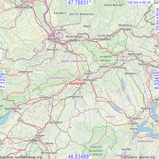
Gunzgen GPS coordinates[2]
47° 18' 49.5" North, 7° 49' 51.672" East
| Map corner | latitude | longitude |
|---|---|---|
| Upper-left | 47.78831°, | 7.1279° |
| Center: | 47.31375°, | 7.83102° |
| Lower-right: | 46.83489°, | 8.53415° |
| Map W x H: | 106×106 km | = 65.9×65.9mi |
| max Lat: | 47.76737° ⇑40.2% North |
| Gunzgen: | 47.31375° |
| min Lat: | ⇓59.8% South 45.83203° |
| min Long | Gunzgen | max Long |
| 5.97153° | 7.83102° | 10.44624° |
| W 35.2%⇐ | ⇒64.8% E |
Elevation
Elevation of Gunzgen is 437 m = 1434 ft, and this is 121.2 m = 398 ft below average elevation for this country.
| Max E: |
1845 m = 6053 ft | 71.5% |
| Avg. | 558.2 m = 1831 ft | |
| Gunzgen | 437 m = 1434 ft | |
Min E: |
197 m = 646 ft | 28.5% |
See also: Switzerland elevation on elevation.city.
Geographical zone
Gunzgen is located in North temperate zone (between Tropic of Cancer and the Arctic Circle). Distance of this North polar circle is 2140.4 km =1330 mi to North.| Distance of | km | miles | from Gunzgen |
|---|---|---|---|
| North Pole | 4746.3 | 2949.2 | to North |
| Arctic Circle | 2140.4 | 1330 | to North |
| Tropic Cancer | 2654.9 | 1649.7 | to South |
| Equator | 5260.8 | 3268.9 | to South |


Nearby cities:
15 places around Gunzgen: (largest is in red/bold)
• Aarburg
5.2 km =3.2 mi,  81°
81°
• Egerkingen
3.6 km =2.2 mi,  280°
280°
• Fulenbach
4.8 km =3 mi,  179°
179°
• Holderbank
6.3 km =3.9 mi,  290°
290°
• Hägendorf
2.5 km =1.6 mi,  18°
18°
• Langenbruck
6.2 km =3.9 mi,  309°
309°
• Murgenthal
4.7 km =2.9 mi,  172°
172°
• Niederbuchsiten
4.9 km =3 mi,  246°
246°
• Oberbuchsiten
4.7 km =2.9 mi,  269°
269°
• Olten
6.8 km =4.2 mi,  53°
53°
• Rothrist
4.7 km =2.9 mi,  101°
101°
• Vordemwald
6.8 km =4.2 mi,  128°
128°
• Wangen
4.4 km =2.7 mi,  41°
41°
• Wolfwil
5.6 km =3.5 mi,  207°
207°
• Wynau
6.5 km =4 mi,  189°
189°
Sources, notices
• [Note1] Compared only with cities in Switzerland existing in our database
• [Src1] Map data: © OpenStreetMap contributors (CC-BY-SA)
• [Src2] Other city data from geonames.org with taken over terms of usage.
• [Src3] Geographical zone / Annual Mean Temperature by Robert A. Rohde @ Wikipedia
