Langenbruck geodata
Langenbruck (Basel-Landschaft) is a populated place; located in Switzerland in Europe/Zurich (GMT+2) time zone. With population of 1,049 people, there are 1297 cities with bigger population in this country. Compared to other cities in Switzerland, 64.5% of cities are located further ↓South; 66.8% of cities are located further →East and 83.1% of cities have lower elevation than Langenbruck. Note1
Administrative division(s):
- Level 1: Basel-Landschaft
- Level 2: Bezirk Waldenburg
- Level 3: Langenbruck


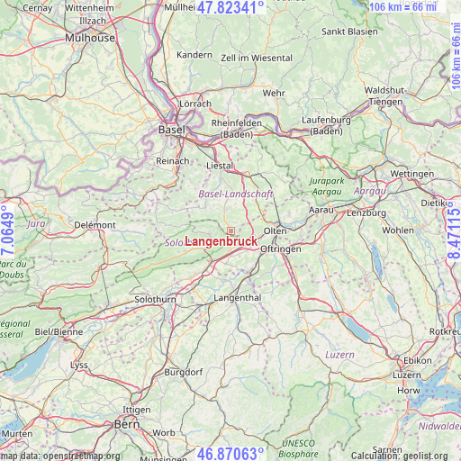
Langenbruck GPS coordinates[2]
47° 20' 57.012" North, 7° 46' 4.872" East
| Map corner | latitude | longitude |
|---|---|---|
| Upper-left | 47.82341°, | 7.0649° |
| Center: | 47.34917°, | 7.76802° |
| Lower-right: | 46.87063°, | 8.47115° |
| Map W x H: | 105.9×105.9 km | = 65.8×65.8mi |
| max Lat: | 47.76737° ⇑35.5% North |
| Langenbruck: | 47.34917° |
| min Lat: | ⇓64.5% South 45.83203° |
| min Long | Langenbruck | max Long |
| 5.97153° | 7.76802° | 10.44624° |
| W 33.2%⇐ | ⇒66.8% E |
Elevation
Elevation of Langenbruck is 707 m = 2320 ft, and this is 148.8 m = 488 ft above average elevation for this country.
| Max E: |
1845 m = 6053 ft | 16.9% |
| Langenbruck | 707 m 2320 ft | |
| Avg. | 558.2 m = 1831 ft | |
Min E: |
197 m = 646 ft | 83.1% |
See also: Switzerland elevation on elevation.city.
Geographical zone
Langenbruck is located in North temperate zone (between Tropic of Cancer and the Arctic Circle). Distance of this North polar circle is 2136.4 km =1327.5 mi to North.| Distance of | km | miles | from Langenbruck |
|---|---|---|---|
| North Pole | 4742.3 | 2946.7 | to North |
| Arctic Circle | 2136.4 | 1327.5 | to North |
| Tropic Cancer | 2658.8 | 1652.1 | to South |
| Equator | 5264.7 | 3271.3 | to South |


Nearby cities:
15 places around Langenbruck: (largest is in red/bold)
• Arboldswil
8.2 km =5.1 mi,  332°
332°
• Balsthal
6.7 km =4.2 mi,  236°
236°
• Diegten
7.9 km =4.9 mi,  24°
24°
• Egerkingen
3.5 km =2.2 mi,  159°
159°
• Gunzgen
6.2 km =3.9 mi,  129°
129°
• Holderbank
2.1 km =1.3 mi,  213°
213°
• Hägendorf
5.7 km =3.5 mi,  105°
105°
• Hölstein
8.2 km =5.1 mi,  1°
1°
• Niederbuchsiten
5.9 km =3.7 mi,  177°
177°
• Oberbuchsiten
4 km =2.5 mi, 179°
• Oberdorf
5.1 km =3.2 mi,  346°
346°
• Oensingen
7.9 km =4.9 mi, 209°
• Reigoldswil
8.2 km =5.1 mi,  311°
311°
• Waldenburg
4 km =2.5 mi,  340°
340°
• Wangen
7.7 km =4.8 mi,  94°
94°
Sources, notices
• [Note1] Compared only with cities in Switzerland existing in our database
• [Src1] Map data: © OpenStreetMap contributors (CC-BY-SA)
• [Src2] Other city data from geonames.org with taken over terms of usage.
• [Src3] Geographical zone / Annual Mean Temperature by Robert A. Rohde @ Wikipedia
