Ecublens geodata
Ecublens (Fribourg) is a populated place; located in Switzerland in Europe/Zurich (GMT+2) time zone. With population of 10,065 people, there are 148 cities with bigger population in this country. Compared to other cities in Switzerland, 82.1% of cities are located further ↑North; 91.4% of cities are located further →East and 72.4% of cities have lower elevation than Ecublens. Note1


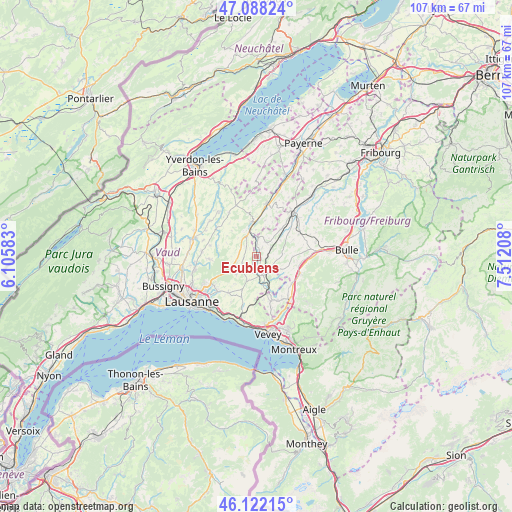
Ecublens GPS coordinates[2]
46° 36' 26.46" North, 6° 48' 32.22" East
| Map corner | latitude | longitude |
|---|---|---|
| Upper-left | 47.08824°, | 6.10583° |
| Center: | 46.60735°, | 6.80895° |
| Lower-right: | 46.12215°, | 7.51208° |
| Map W x H: | 107.4×107.4 km | = 66.7×66.7mi |
| max Lat: | 47.76737° ⇑82.1% North |
| Ecublens: | 46.60735° |
| min Lat: | ⇓17.9% South 45.83203° |
| min Long | Ecublens | max Long |
| 5.97153° | 6.80895° | 10.44624° |
| W 8.6%⇐ | ⇒91.4% E |
Elevation
Elevation of Ecublens is 591 m = 1939 ft, and this is 32.8 m = 108 ft above average elevation for this country.
| Max E: |
1845 m = 6053 ft | 27.6% |
| Ecublens | 591 m 1939 ft | |
| Avg. | 558.2 m = 1831 ft | |
Min E: |
197 m = 646 ft | 72.4% |
See also: Switzerland elevation on elevation.city.
Geographical zone
Ecublens is located in North temperate zone (between Tropic of Cancer and the Arctic Circle). Distance of this North polar circle is 2218.9 km =1378.8 mi to North.| Distance of | km | miles | from Ecublens |
|---|---|---|---|
| North Pole | 4824.8 | 2998 | to North |
| Arctic Circle | 2218.9 | 1378.8 | to North |
| Tropic Cancer | 2576.3 | 1600.8 | to South |
| Equator | 5182.3 | 3220.1 | to South |


Nearby cities:
15 places around Ecublens: (largest is in red/bold)
• Bottens
11.3 km =7 mi,  274°
274°
• Châtel-Saint-Denis
11.4 km =7.1 mi,  141°
141°
• Corcelles-le-Jorat
5.1 km =3.2 mi, 268°
• Froideville
9.8 km =6.1 mi, 266°
• Maracon
8 km =5 mi, 142°
• Moudon
6.8 km =4.2 mi,  352°
352°
• Oron-la-Ville
4.2 km =2.6 mi,  162°
162°
• Palézieux
7.7 km =4.8 mi, 161°
• Rue
1.7 km =1.1 mi,  37°
37°
• Savigny
9.6 km =6 mi,  217°
217°
• Semsales
10 km =6.2 mi,  112°
112°
• Servion
4.7 km =2.9 mi,  210°
210°
• Siviriez
7.7 km =4.8 mi, 42°
• Sottens
7.4 km =4.6 mi,  316°
316°
• Vuisternens-devant-Romont
10.5 km =6.5 mi,  61°
61°
Sources, notices
• [Note1] Compared only with cities in Switzerland existing in our database
• [Src1] Map data: © OpenStreetMap contributors (CC-BY-SA)
• [Src2] Other city data from geonames.org with taken over terms of usage.
• [Src3] Geographical zone / Annual Mean Temperature by Robert A. Rohde @ Wikipedia
