Froideville geodata
Froideville (Vaud) is a populated place; located in Switzerland in Europe/Zurich (GMT+2) time zone. With population of 1,518 people, there are 1026 cities with bigger population in this country. Compared to other cities in Switzerland, 82.5% of cities are located further ↑North; 92.7% of cities are located further →East and 89.4% of cities have lower elevation than Froideville. Note1


Froideville GPS coordinates[2]
46° 36' 4.428" North, 6° 40' 51.06" East
| Map corner | latitude | longitude |
|---|---|---|
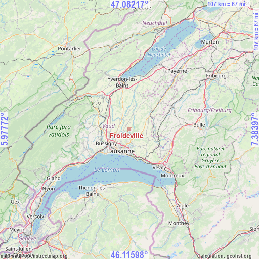
| Upper-left | 47.08217°, | 5.97772° |
| Center: | 46.60123°, | 6.68085° |
| Lower-right: | 46.11598°, | 7.38397° |
| Map W x H: | 107.4×107.4 km | = 66.7×66.7mi |
| max Lat: | 47.76737° ⇑82.5% North |
| Froideville: | 46.60123° |
| min Lat: | ⇓17.5% South 45.83203° |
| min Long | Froideville | max Long |
| 5.97153° | 6.68085° | 10.44624° |
| W 7.3%⇐ | ⇒92.7% E |
Elevation
Elevation of Froideville is 811 m = 2661 ft, and this is 252.8 m = 829 ft above average elevation for this country.
| Max E: |
1845 m = 6053 ft | 10.6% |
| Froideville | 811 m 2661 ft | |
| Avg. | 558.2 m = 1831 ft | |
Min E: |
197 m = 646 ft | 89.4% |
See also: Switzerland elevation on elevation.city.
Geographical zone
Froideville is located in North temperate zone (between Tropic of Cancer and the Arctic Circle). Distance of this North polar circle is 2219.6 km =1379.2 mi to North.| Distance of | km | miles | from Froideville |
|---|---|---|---|
| North Pole | 4825.5 | 2998.4 | to North |
| Arctic Circle | 2219.6 | 1379.2 | to North |
| Tropic Cancer | 2575.7 | 1600.5 | to South |
| Equator | 5181.6 | 3219.7 | to South |


Nearby cities:
15 places around Froideville: (largest is in red/bold)
• Assens
4.7 km =2.9 mi,  286°
286°
• Belmont-sur-Lausanne
9.2 km =5.7 mi,  182°
182°
• Blécherette
8.2 km =5.1 mi,  213°
213°
• Bottens
2.2 km =1.4 mi,  317°
317°
• Cheseaux
6 km =3.7 mi,  253°
253°
• Corcelles-le-Jorat
4.8 km =3 mi,  82°
82°
• Echallens
5.8 km =3.6 mi, 320°
• Epalinges
5.9 km =3.7 mi,  189°
189°
• Goumoens-la-Ville
8.7 km =5.4 mi, 317°
• Le Mont-sur-Lausanne
6.1 km =3.8 mi,  218°
218°
• Prilly
9.2 km =5.7 mi, 219°
• Romanel-sur-Lausanne
7.1 km =4.4 mi,  234°
234°
• Savigny
8 km =5 mi,  150°
150°
• Servion
8.2 km =5.1 mi,  114°
114°
• Sottens
7.6 km =4.7 mi,  37°
37°
Sources, notices
• [Note1] Compared only with cities in Switzerland existing in our database
• [Src1] Map data: © OpenStreetMap contributors (CC-BY-SA)
• [Src2] Other city data from geonames.org with taken over terms of usage.
• [Src3] Geographical zone / Annual Mean Temperature by Robert A. Rohde @ Wikipedia
