Bercher geodata
Bercher (Vaud) is a populated place; located in Switzerland in Europe/Zurich (GMT+2) time zone. With population of 900 people, there are 1414 cities with bigger population in this country. Compared to other cities in Switzerland, 78.8% of cities are located further ↑North; 92.5% of cities are located further →East and 77.3% of cities have lower elevation than Bercher. Note1


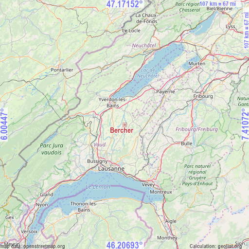
Bercher GPS coordinates[2]
46° 41' 28.968" North, 6° 42' 27.324" East
| Map corner | latitude | longitude |
|---|---|---|
| Upper-left | 47.17152°, | 6.00447° |
| Center: | 46.69138°, | 6.70759° |
| Lower-right: | 46.20693°, | 7.41072° |
| Map W x H: | 107.3×107.3 km | = 66.7×66.7mi |
| max Lat: | 47.76737° ⇑78.8% North |
| Bercher: | 46.69138° |
| min Lat: | ⇓21.2% South 45.83203° |
| min Long | Bercher | max Long |
| 5.97153° | 6.70759° | 10.44624° |
| W 7.5%⇐ | ⇒92.5% E |
Elevation
Elevation of Bercher is 637 m = 2090 ft, and this is 78.8 m = 259 ft above average elevation for this country.
| Max E: |
1845 m = 6053 ft | 22.7% |
| Bercher | 637 m 2090 ft | |
| Avg. | 558.2 m = 1831 ft | |
Min E: |
197 m = 646 ft | 77.3% |
See also: Switzerland elevation on elevation.city.
Geographical zone
Bercher is located in North temperate zone (between Tropic of Cancer and the Arctic Circle). Distance of this North polar circle is 2209.6 km =1373 mi to North.| Distance of | km | miles | from Bercher |
|---|---|---|---|
| North Pole | 4815.5 | 2992.2 | to North |
| Arctic Circle | 2209.6 | 1373 | to North |
| Tropic Cancer | 2585.7 | 1606.7 | to South |
| Equator | 5191.6 | 3225.9 | to South |


Nearby cities:
15 places around Bercher: (largest is in red/bold)
• Bottens
9.1 km =5.7 mi,  202°
202°
• Chavornay
10.6 km =6.6 mi,  276°
276°
• Cheseaux-Noréaz
10.5 km =6.5 mi,  344°
344°
• Corcelles-le-Jorat
9.8 km =6.1 mi,  164°
164°
• Echallens
8 km =5 mi,  225°
225°
• Froideville
10.2 km =6.3 mi,  191°
191°
• Goumoens-la-Ville
8.7 km =5.4 mi,  245°
245°
• Lucens
10.2 km =6.3 mi,  79°
79°
• Moudon
7.4 km =4.6 mi,  111°
111°
• Pailly
2.7 km =1.7 mi,  294°
294°
• Penthéréaz
8 km =5 mi,  262°
262°
• Rueyres
1.2 km =0.7 mi, 280°
• Sottens
4.8 km =3 mi,  146°
146°
• Thierrens
3.9 km =2.4 mi,  69°
69°
• Vuarrens
4.6 km =2.9 mi, 262°
Sources, notices
• [Note1] Compared only with cities in Switzerland existing in our database
• [Src1] Map data: © OpenStreetMap contributors (CC-BY-SA)
• [Src2] Other city data from geonames.org with taken over terms of usage.
• [Src3] Geographical zone / Annual Mean Temperature by Robert A. Rohde @ Wikipedia
