Puerto Montt geodata
Puerto Montt (Los Lagos Region) is a seat of a first-order administrative division; located in Chile in America/Santiago (GMT-4) time zone. With population of 160,054 people, there are 15 cities with bigger population in this country. Compared to other cities in Chile, 85.5% of cities are located further ↑North; 79.3% of cities are located further →East and 81.4% of cities have higher elevation than Puerto Montt. Note1
Administrative division(s):
- Level 1: Los Lagos Region
- Level 2: Provincia de Llanquihue
- Level 3: Puerto Montt


Puerto Montt GPS coordinates[2]
41° 28' 9.48" South, 72° 56' 32.532" West
| Map corner | latitude | longitude |
|---|---|---|
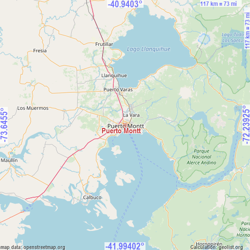
| Upper-left | -40.9403°, | -73.6455° |
| Center: | -41.4693°, | -72.94237° |
| Lower-right: | -41.99402°, | -72.23925° |
| Map W x H: | 117.2×117.2 km | = 72.8×72.8mi |
| max Lat: | -18.19821° ⇑85.5% North |
| Puerto Montt: | -41.4693° |
| min Lat: | ⇓14.5% South -54.93355° |
| min Long | Puerto Montt | max Long |
| -109.42438° | -72.94237° | -67.60963° |
| W 20.7%⇐ | ⇒79.3% E |
Elevation
Elevation of Puerto Montt is 27 m = 89 ft, and this is 246 m = 807 ft below average elevation for this country.
| Max E: |
3544 m = 11627 ft | 81.4% |
| Avg. | 273 m = 896 ft | |
| Puerto Montt | 27 m = 89 ft | |
Min E: |
1 m = 3 ft | 18.6% |
See also: Puerto Montt elevation on elevation.city.
Geographical zone
Puerto Montt is located in South temperate zone (between Tropic of Capricorn and the Antarctic Circle). Distance of this Southern Tropic circle is 2005 km =1245.8 mi to North.| Distance of | km | miles | from Puerto Montt |
|---|---|---|---|
| Equator | 4611 | 2865.1 | to North |
| Tropic Capricorn | 2005 | 1245.8 | to North |
| Antarctic Circle | 2790.2 | 1733.7 | to South |
| South Pole | 5396.1 | 3353 | to South |


Nearby cities:
15 places around Puerto Montt: (largest is in red/bold)
• Ancud
85.2 km =52.9 mi,  238°
238°
• Calbuco
37.3 km =23.2 mi,  204°
204°
• Castro
131 km =81.4 mi,  211°
211°
• Chaitén
162 km =100.7 mi,  173°
173°
• Chonchi
145.6 km =90.5 mi, 208°
• Dalcahue
116.8 km =72.6 mi, 210°
• La Ensenada
44.6 km =27.7 mi,  49°
49°
• La Unión
131.3 km =81.6 mi,  354°
354°
• Las Gaviotas
179.4 km =111.5 mi, 353°
• Osorno
100.8 km =62.6 mi, 350°
• Puerto Varas
17 km =10.6 mi, 347°
• Purranque
64.5 km =40.1 mi,  343°
343°
• Puyehue
94.5 km =58.7 mi,  17°
17°
• Río Bueno
126.1 km =78.4 mi,  359°
359°
• Santa Rosa
147.3 km =91.5 mi,  12°
12°
Sources, notices
• [Note1] Compared only with cities in Chile existing in our database
• [Src1] Map data: © OpenStreetMap contributors (CC-BY-SA)
• [Src2] Other city data from geonames.org with taken over terms of usage.
• [Src3] Geographical zone / Annual Mean Temperature by Robert A. Rohde @ Wikipedia
