Chaitén geodata
Chaitén (Los Lagos Region) is a populated place; located in Chile in America/Santiago (GMT-4) time zone. With population of 4,065 people, there are 118 cities with bigger population in this country. Compared to other cities in Chile, 89.7% of cities are located further ↑North; 76.6% of cities are located further →East and 90.3% of cities have higher elevation than Chaitén. Note1


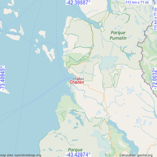
Chaitén GPS coordinates[2]
42° 54' 57.456" South, 72° 42' 22.752" West
| Map corner | latitude | longitude |
|---|---|---|
| Upper-left | -42.39887°, | -73.40945° |
| Center: | -42.91596°, | -72.70632° |
| Lower-right: | -43.42874°, | -72.0032° |
| Map W x H: | 114.5×114.5 km | = 71.1×71.1mi |
| max Lat: | -18.19821° ⇑89.7% North |
| Chaitén: | -42.91596° |
| min Lat: | ⇓10.3% South -54.93355° |
| min Long | Chaitén | max Long |
| -109.42438° | -72.70632° | -67.60963° |
| W 23.4%⇐ | ⇒76.6% E |
Elevation
Elevation of Chaitén is 17 m = 56 ft, and this is 256 m = 840 ft below average elevation for this country.
| Max E: |
3544 m = 11627 ft | 90.3% |
| Avg. | 273 m = 896 ft | |
| Chaitén | 17 m = 56 ft | |
Min E: |
1 m = 3 ft | 9.7% |
See also: Chile elevation on elevation.city.
Geographical zone
Chaitén is located in South temperate zone (between Tropic of Capricorn and the Antarctic Circle). Distance of this Southern Tropic circle is 2165.9 km =1345.8 mi to North.| Distance of | km | miles | from Chaitén |
|---|---|---|---|
| Equator | 4771.8 | 2965.1 | to North |
| Tropic Capricorn | 2165.9 | 1345.8 | to North |
| Antarctic Circle | 2629.4 | 1633.8 | to South |
| South Pole | 5235.3 | 3253.1 | to South |


Nearby cities:
15 places around Chaitén: (largest is in red/bold)
• Ancud
147.7 km =91.8 mi,  321°
321°
• Calbuco
131.7 km =81.8 mi,  344°
344°
• Castro
100.2 km =62.3 mi,  299°
299°
• Chonchi
93.1 km =57.8 mi,  290°
290°
• Dalcahue
97.6 km =60.6 mi,  307°
307°
• Futaleufú
74.4 km =46.2 mi,  113°
113°
• La Ensenada
190.5 km =118.4 mi,  4°
4°
• La Junta
120.2 km =74.7 mi,  168°
168°
• Palena
107 km =66.5 mi,  136°
136°
• Puerto Cisnes
203.6 km =126.5 mi,  179°
179°
• Puerto Montt
162 km =100.7 mi,  353°
353°
• Puerto Varas
179 km =111.2 mi, 352°
• Purranque
225.8 km =140.3 mi, 350°
• Puyehue
251.1 km =156 mi, 1°
• Quellón
77.3 km =48 mi,  253°
253°
Sources, notices
• [Note1] Compared only with cities in Chile existing in our database
• [Src1] Map data: © OpenStreetMap contributors (CC-BY-SA)
• [Src2] Other city data from geonames.org with taken over terms of usage.
• [Src3] Geographical zone / Annual Mean Temperature by Robert A. Rohde @ Wikipedia
