Puerto Aysén geodata
Puerto Aysén (Aysén) is a seat of a second-order administrative division; located in Chile in America/Santiago (GMT-4) time zone. With population of 16,936 people, there are 88 cities with bigger population in this country. Compared to other cities in Chile, 93.8% of cities are located further ↑North; 75.2% of cities are located further →East and 97.9% of cities have higher elevation than Puerto Aysén. Note1


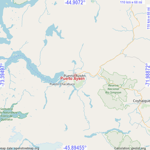
Puerto Aysén GPS coordinates[2]
45° 24' 10.908" South, 72° 41' 30.624" West
| Map corner | latitude | longitude |
|---|---|---|
| Upper-left | -44.9072°, | -73.39497° |
| Center: | -45.40303°, | -72.69184° |
| Lower-right: | -45.89455°, | -71.98872° |
| Map W x H: | 109.8×109.8 km | = 68.2×68.2mi |
| max Lat: | -18.19821° ⇑93.8% North |
| Puerto Aysén: | -45.40303° |
| min Lat: | ⇓6.2% South -54.93355° |
| min Long | Puerto Aysén | max Long |
| -109.42438° | -72.69184° | -67.60963° |
| W 24.8%⇐ | ⇒75.2% E |
Elevation
Elevation of Puerto Aysén is 9 m = 30 ft, and this is 264 m = 866 ft below average elevation for this country.
| Max E: |
3544 m = 11627 ft | 97.9% |
| Avg. | 273 m = 896 ft | |
| Puerto Aysén | 9 m = 30 ft | |
Min E: |
1 m = 3 ft | 2.1% |
See also: Chile elevation on elevation.city.
Geographical zone
Puerto Aysén is located in South temperate zone (between Tropic of Capricorn and the Antarctic Circle). Distance of this South polar circle is 2352.8 km =1462 mi to South.| Distance of | km | miles | from Puerto Aysén |
|---|---|---|---|
| Equator | 5048.3 | 3136.9 | to North |
| Tropic Capricorn | 2442.4 | 1517.6 | to North |
| Antarctic Circle | 2352.8 | 1462 | to South |
| South Pole | 4958.7 | 3081.2 | to South |


Nearby cities:
15 places around Puerto Aysén: (largest is in red/bold)
• Ancud
403 km =250.4 mi,  347°
347°
• Calbuco
405.1 km =251.7 mi, 354°
• Castro
337.2 km =209.5 mi, 345°
• Chaitén
276.5 km =171.8 mi,  359°
359°
• Chile Chico
147 km =91.3 mi,  149°
149°
• Chonchi
320.9 km =199.4 mi,  344°
344°
• Cochrane
206.2 km =128.1 mi,  177°
177°
• Coyhaique
52.4 km =32.6 mi,  111°
111°
• Dalcahue
344.9 km =214.3 mi, 347°
• Futaleufú
255.2 km =158.6 mi,  14°
14°
• La Junta
160.5 km =99.7 mi, 8°
• Palena
210.5 km =130.8 mi,  19°
19°
• Puerto Chacabuco
12 km =7.5 mi,  234°
234°
• Puerto Cisnes
72.9 km =45.3 mi, 359°
• Quellón
264.5 km =164.4 mi, 343°
Sources, notices
• [Note1] Compared only with cities in Chile existing in our database
• [Src1] Map data: © OpenStreetMap contributors (CC-BY-SA)
• [Src2] Other city data from geonames.org with taken over terms of usage.
• [Src3] Geographical zone / Annual Mean Temperature by Robert A. Rohde @ Wikipedia
