Puerto Chacabuco geodata
Puerto Chacabuco (Aysén) is a populated place; located in Chile in America/Santiago (GMT-4) time zone. With population of 1,243 people, there are 131 cities with bigger population in this country. Compared to other cities in Chile, 94.5% of cities are located further ↑North; 78.6% of cities are located further →East and 79.3% of cities have higher elevation than Puerto Chacabuco. Note1


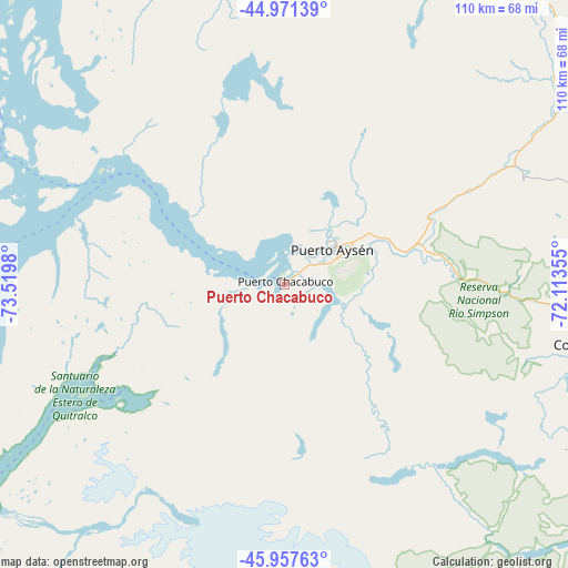
Puerto Chacabuco GPS coordinates[2]
45° 28' 0.012" South, 72° 49' 0.012" West
| Map corner | latitude | longitude |
|---|---|---|
| Upper-left | -44.97139°, | -73.5198° |
| Center: | -45.46667°, | -72.81667° |
| Lower-right: | -45.95763°, | -72.11355° |
| Map W x H: | 109.7×109.7 km | = 68.2×68.2mi |
| max Lat: | -18.19821° ⇑94.5% North |
| Puerto Chacabuco: | -45.46667° |
| min Lat: | ⇓5.5% South -54.93355° |
| min Long | Puerto Chacabuc | max Long |
| -109.42438° | -72.81667° | -67.60963° |
| W 21.4%⇐ | ⇒78.6% E |
Elevation
Elevation of Puerto Chacabuco is 29 m = 95 ft, and this is 244 m = 801 ft below average elevation for this country.
| Max E: |
3544 m = 11627 ft | 79.3% |
| Avg. | 273 m = 896 ft | |
| Puerto Chacabuco | 29 m = 95 ft | |
Min E: |
1 m = 3 ft | 20.7% |
See also: Chile elevation on elevation.city.
Geographical zone
Puerto Chacabuco is located in South temperate zone (between Tropic of Capricorn and the Antarctic Circle). Distance of this South polar circle is 2345.8 km =1457.6 mi to South.| Distance of | km | miles | from Puerto Chacabuco |
|---|---|---|---|
| Equator | 5055.4 | 3141.3 | to North |
| Tropic Capricorn | 2449.5 | 1522 | to North |
| Antarctic Circle | 2345.8 | 1457.6 | to South |
| South Pole | 4951.6 | 3076.8 | to South |


Nearby cities:
15 places around Puerto Chacabuco: (largest is in red/bold)
• Ancud
407.8 km =253.4 mi,  348°
348°
• Calbuco
411.4 km =255.6 mi,  356°
356°
• Castro
341.6 km =212.3 mi, 347°
• Chaitén
283.7 km =176.3 mi,  1°
1°
• Chile Chico
146.3 km =90.9 mi,  144°
144°
• Chonchi
325.2 km =202.1 mi, 346°
• Cochrane
199.8 km =124.1 mi,  174°
174°
• Coyhaique
59.7 km =37.1 mi,  101°
101°
• Dalcahue
349.8 km =217.4 mi, 349°
• Futaleufú
264.7 km =164.5 mi,  16°
16°
• La Junta
169.1 km =105.1 mi,  11°
11°
• Palena
220.6 km =137.1 mi, 21°
• Puerto Aysén
12 km =7.5 mi,  54°
54°
• Puerto Cisnes
80.5 km =50 mi, 6°
• Quellón
268.8 km =167 mi, 346°
Sources, notices
• [Note1] Compared only with cities in Chile existing in our database
• [Src1] Map data: © OpenStreetMap contributors (CC-BY-SA)
• [Src2] Other city data from geonames.org with taken over terms of usage.
• [Src3] Geographical zone / Annual Mean Temperature by Robert A. Rohde @ Wikipedia
