Vallenar geodata
Vallenar (Atacama) is a seat of a third-order administrative division; located in Chile in America/Santiago (GMT-4) time zone. In our database, there are 135 cities with bigger population. Compared to other cities in Chile, 90.3% of cities are located further ↓South; 93.1% of cities are located further ←West and 97.9% of cities have lower elevation than Vallenar. Note1


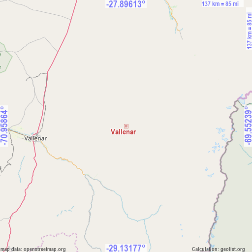
Vallenar GPS coordinates[2]
28° 30' 56.736" South, 70° 15' 19.836" West
| Map corner | latitude | longitude |
|---|---|---|
| Upper-left | -27.89613°, | -70.95864° |
| Center: | -28.51576°, | -70.25551° |
| Lower-right: | -29.13177°, | -69.55239° |
| Map W x H: | 137.4×137.4 km | = 85.4×85.4mi |
| max Lat: | -18.19821° ⇑9.7% North |
| Vallenar: | -28.51576° |
| min Lat: | ⇓90.3% South -54.93355° |
| min Long | Vallenar | max Long |
| -109.42438° | -70.25551° | -67.60963° |
| W 93.1%⇐ | ⇒6.9% E |
Elevation
Elevation of Vallenar is 1990 m = 6529 ft, and this is 1717 m = 5633 ft above average elevation for this country.
| Max E: |
3544 m = 11627 ft | 2.1% |
| Vallenar | 1990 m 6529 ft | |
| Avg. | 273 m = 896 ft | |
Min E: |
1 m = 3 ft | 97.9% |
See also: Chile elevation on elevation.city.
Geographical zone
Vallenar is located in South temperate zone (between Tropic of Capricorn and the Antarctic Circle). Distance of this Southern Tropic circle is 564.7 km =350.9 mi to North.| Distance of | km | miles | from Vallenar |
|---|---|---|---|
| Equator | 3170.7 | 1970.2 | to North |
| Tropic Capricorn | 564.7 | 350.9 | to North |
| Antarctic Circle | 4230.5 | 2628.7 | to South |
| South Pole | 6836.4 | 4247.9 | to South |


Nearby cities:
12 places around Vallenar: (largest is in red/bold)
• Chañaral
244.2 km =151.7 mi,  351°
351°
• Copiapó
128 km =79.5 mi,  356°
356°
• Coquimbo
191.3 km =118.9 mi,  213°
213°
• Diego de Almagro
239.8 km =149 mi,  4°
4°
• Illapel
357.6 km =222.2 mi,  194°
194°
• La Serena
182 km =113.1 mi, 211°
• Monte Patria
251.6 km =156.3 mi,  195°
195°
• Ovalle
249.2 km =154.8 mi, 201°
• Salamanca
369.2 km =229.4 mi, 190°
• Taltal
346.4 km =215.2 mi, 356°
• Vallenar
49.7 km =30.9 mi,  262°
262°
• Vicuña
174.7 km =108.6 mi, 194°
Sources, notices
• [Note1] Compared only with cities in Chile existing in our database
• [Src1] Map data: © OpenStreetMap contributors (CC-BY-SA)
• [Src2] Other city data from geonames.org with taken over terms of usage.
• [Src3] Geographical zone / Annual Mean Temperature by Robert A. Rohde @ Wikipedia
