Vicuña geodata
Vicuña (Coquimbo Region) is a populated place; located in Chile in America/Santiago (GMT-4) time zone. With population of 13,496 people, there are 102 cities with bigger population in this country. Compared to other cities in Chile, 87.6% of cities are located further ↓South; 81.4% of cities are located further ←West and 92.4% of cities have lower elevation than Vicuña. Note1


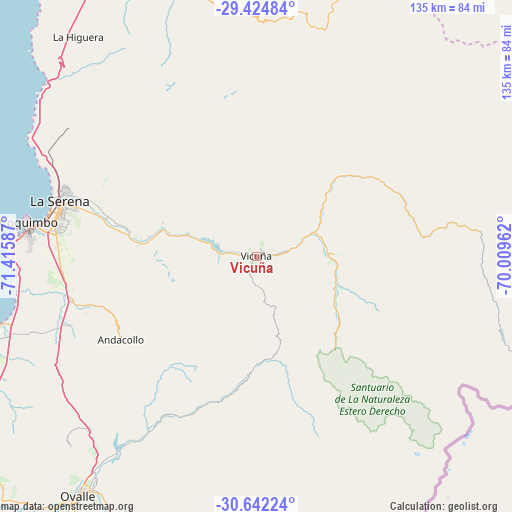
Vicuña GPS coordinates[2]
30° 2' 7.476" South, 70° 42' 45.864" West
| Map corner | latitude | longitude |
|---|---|---|
| Upper-left | -29.42484°, | -71.41587° |
| Center: | -30.03541°, | -70.71274° |
| Lower-right: | -30.64224°, | -70.00962° |
| Map W x H: | 135.4×135.4 km | = 84.1×84.1mi |
| max Lat: | -18.19821° ⇑12.4% North |
| Vicuña: | -30.03541° |
| min Lat: | ⇓87.6% South -54.93355° |
| min Long | Vicuña | max Long |
| -109.42438° | -70.71274° | -67.60963° |
| W 81.4%⇐ | ⇒18.6% E |
Elevation
Elevation of Vicuña is 616 m = 2021 ft, and this is 343 m = 1125 ft above average elevation for this country.
| Max E: |
3544 m = 11627 ft | 7.6% |
| Vicuña | 616 m 2021 ft | |
| Avg. | 273 m = 896 ft | |
Min E: |
1 m = 3 ft | 92.4% |
See also: Chile elevation on elevation.city.
Geographical zone
Vicuña is located in South temperate zone (between Tropic of Capricorn and the Antarctic Circle). Distance of this Southern Tropic circle is 733.7 km =455.9 mi to North.| Distance of | km | miles | from Vicuña |
|---|---|---|---|
| Equator | 3339.6 | 2075.1 | to North |
| Tropic Capricorn | 733.7 | 455.9 | to North |
| Antarctic Circle | 4061.5 | 2523.7 | to South |
| South Pole | 6667.4 | 4142.9 | to South |


Nearby cities:
15 places around Vicuña: (largest is in red/bold)
• Copiapó
299 km =185.8 mi,  7°
7°
• Coquimbo
61 km =37.9 mi,  278°
278°
• Hacienda La Calera
309.3 km =192.2 mi,  188°
188°
• Illapel
183 km =113.7 mi, 193°
• La Ligua
273.2 km =169.8 mi, 190°
• La Serena
53.7 km =33.4 mi,  285°
285°
• Llaillay
312.7 km =194.3 mi,  184°
184°
• Los Andes
311.3 km =193.4 mi, 178°
• Monte Patria
77 km =47.8 mi,  197°
197°
• Ovalle
78.3 km =48.7 mi,  216°
216°
• Quillota
320.7 km =199.3 mi, 189°
• Salamanca
195.4 km =121.4 mi, 187°
• San Felipe
301.8 km =187.5 mi, 180°
• Vallenar
162.3 km =100.8 mi,  358°
358°
• Vallenar
174.7 km =108.6 mi, 14°
Sources, notices
• [Note1] Compared only with cities in Chile existing in our database
• [Src1] Map data: © OpenStreetMap contributors (CC-BY-SA)
• [Src2] Other city data from geonames.org with taken over terms of usage.
• [Src3] Geographical zone / Annual Mean Temperature by Robert A. Rohde @ Wikipedia
