Yuncheng geodata
Yuncheng (Shandong) is a seat of a third-order administrative division; located in China in Asia/Shanghai (GMT+8) time zone. In our database, there are 1268 cities with bigger population. Compared to other cities in China, 76.2% of cities are located further ↓South; 59.7% of cities are located further ←West and 71.3% of cities have higher elevation than Yuncheng. Note1


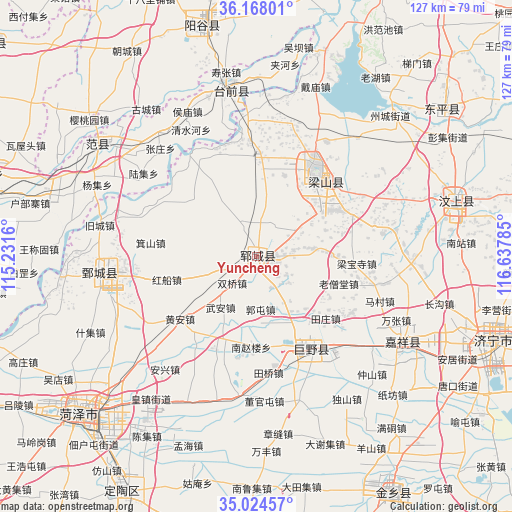
Yuncheng GPS coordinates[2]
35° 35' 53.988" North, 115° 56' 4.992" East
| Map corner | latitude | longitude |
|---|---|---|
| Upper-left | 36.16801°, | 115.2316° |
| Center: | 35.59833°, | 115.93472° |
| Lower-right: | 35.02457°, | 116.63785° |
| Map W x H: | 127.1×127.1 km | = 79×79mi |
| max Lat: | 53.31946° ⇑23.8% North |
| Yuncheng: | 35.59833° |
| min Lat: | ⇓76.2% South 18.22056° |
| min Long | Yuncheng | max Long |
| 75.07348° | 115.93472° | 134.28917° |
| W 59.7%⇐ | ⇒40.3% E |
Elevation
Elevation of Yuncheng is 47 m = 154 ft, and this is 437.8 m = 1436 ft below average elevation for this country.
| Max E: |
5622 m = 18445 ft | 71.3% |
| Avg. | 484.8 m = 1591 ft | |
| Yuncheng | 47 m = 154 ft | |
Min E: |
-3 m = -10 ft | 28.7% |
See also: China elevation on elevation.city.
Geographical zone
Yuncheng is located in North temperate zone (between Tropic of Cancer and the Arctic Circle). Distance of this Northern Tropic circle is 1352.2 km =840.2 mi to South.| Distance of | km | miles | from Yuncheng |
|---|---|---|---|
| North Pole | 6048.9 | 3758.6 | to North |
| Arctic Circle | 3443 | 2139.4 | to North |
| Tropic Cancer | 1352.2 | 840.2 | to South |
| Equator | 3958.2 | 2459.5 | to South |


Nearby cities:
15 places around Yuncheng: (largest is in red/bold)
• Chengwu
71.8 km =44.6 mi,  183°
183°
• Dingtao
67.2 km =41.8 mi,  209°
209°
• Fan Xian Chengguanzhen
48.7 km =30.3 mi,  306°
306°
• Heze
57.8 km =35.9 mi,  226°
226°
• Jiaxiang
43.7 km =27.2 mi,  121°
121°
• Jining
62.4 km =38.8 mi,  110°
110°
• Juancheng
39.4 km =24.5 mi,  264°
264°
• Juye
26.6 km =16.5 mi,  148°
148°
• Ningyang
79.5 km =49.4 mi,  76°
76°
• Wenshang
52.7 km =32.7 mi,  74°
74°
• Xicheng
60 km =37.3 mi, 229°
• Yanggu
58.7 km =36.5 mi,  345°
345°
• Yangying
24.5 km =15.2 mi,  2°
2°
• Yanta
75.4 km =46.9 mi,  341°
341°
• Zhoucheng
48.7 km =30.3 mi,  44°
44°
Sources, notices
• [Note1] Compared only with cities in China existing in our database
• [Src1] Map data: © OpenStreetMap contributors (CC-BY-SA)
• [Src2] Other city data from geonames.org with taken over terms of usage.
• [Src3] Geographical zone / Annual Mean Temperature by Robert A. Rohde @ Wikipedia
