Wenshang geodata
Wenshang (Shandong) is a populated place; located in China in Asia/Shanghai (GMT+8) time zone. With population of 59,455 people, there are 737 cities with bigger population in this country. Compared to other cities in China, 76.6% of cities are located further ↓South; 63% of cities are located further ←West and 72.3% of cities have higher elevation than Wenshang. Note1


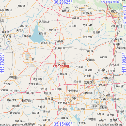
Wenshang GPS coordinates[2]
35° 43' 39" North, 116° 29' 45.996" East
| Map corner | latitude | longitude |
|---|---|---|
| Upper-left | 36.29625°, | 115.79299° |
| Center: | 35.7275°, | 116.49611° |
| Lower-right: | 35.15466°, | 117.19924° |
| Map W x H: | 126.9×126.9 km | = 78.9×78.9mi |
| max Lat: | 53.31946° ⇑23.4% North |
| Wenshang: | 35.7275° |
| min Lat: | ⇓76.6% South 18.22056° |
| min Long | Wenshang | max Long |
| 75.07348° | 116.49611° | 134.28917° |
| W 63%⇐ | ⇒37% E |
Elevation
Elevation of Wenshang is 44 m = 144 ft, and this is 440.8 m = 1446 ft below average elevation for this country.
| Max E: |
5622 m = 18445 ft | 72.3% |
| Avg. | 484.8 m = 1591 ft | |
| Wenshang | 44 m = 144 ft | |
Min E: |
-3 m = -10 ft | 27.7% |
See also: Wenshang elevation on elevation.city.
Geographical zone
Wenshang is located in North temperate zone (between Tropic of Cancer and the Arctic Circle). Distance of this Northern Tropic circle is 1366.6 km =849.2 mi to South.| Distance of | km | miles | from Wenshang |
|---|---|---|---|
| North Pole | 6034.5 | 3749.7 | to North |
| Arctic Circle | 3428.6 | 2130.4 | to North |
| Tropic Cancer | 1366.6 | 849.2 | to South |
| Equator | 3972.5 | 2468.4 | to South |


Nearby cities:
15 places around Wenshang: (largest is in red/bold)
• Feicheng
62.8 km =39 mi,  22°
22°
• Jiaxiang
39.2 km =24.4 mi,  199°
199°
• Jining
36.7 km =22.8 mi,  167°
167°
• Juye
52.2 km =32.4 mi,  224°
224°
• Lingcheng
43.8 km =27.2 mi,  119°
119°
• Ningyang
27 km =16.8 mi,  81°
81°
• Pingyin
61.9 km =38.5 mi,  355°
355°
• Qufu
47 km =29.2 mi,  108°
108°
• Sishui
71 km =44.1 mi,  97°
97°
• Tai’an
75.8 km =47.1 mi,  47°
47°
• Yangying
50.5 km =31.4 mi,  281°
281°
• Yanzhou
35.8 km =22.2 mi, 122°
• Yuncheng
52.7 km =32.7 mi,  254°
254°
• Zhoucheng
26.4 km =16.4 mi,  321°
321°
• Zoucheng
55.9 km =34.7 mi,  130°
130°
Sources, notices
• [Note1] Compared only with cities in China existing in our database
• [Src1] Map data: © OpenStreetMap contributors (CC-BY-SA)
• [Src2] Other city data from geonames.org with taken over terms of usage.
• [Src3] Geographical zone / Annual Mean Temperature by Robert A. Rohde @ Wikipedia
