Zhoucheng geodata
Zhoucheng (Shandong) is a populated place; located in China in Asia/Shanghai (GMT+8) time zone. With population of 72,070 people, there are 596 cities with bigger population in this country. Compared to other cities in China, 77% of cities are located further ↓South; 61.8% of cities are located further ←West and 73.3% of cities have higher elevation than Zhoucheng. Note1


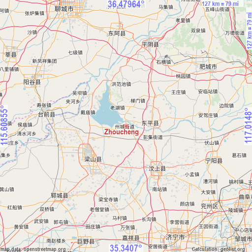
Zhoucheng GPS coordinates[2]
35° 54' 43.992" North, 116° 18' 42.012" East
| Map corner | latitude | longitude |
|---|---|---|
| Upper-left | 36.47964°, | 115.60855° |
| Center: | 35.91222°, | 116.31167° |
| Lower-right: | 35.3407°, | 117.0148° |
| Map W x H: | 126.6×126.6 km | = 78.7×78.7mi |
| max Lat: | 53.31946° ⇑23% North |
| Zhoucheng: | 35.91222° |
| min Lat: | ⇓77% South 18.22056° |
| min Long | Zhoucheng | max Long |
| 75.07348° | 116.31167° | 134.28917° |
| W 61.8%⇐ | ⇒38.2% E |
Elevation
Elevation of Zhoucheng is 41 m = 135 ft, and this is 443.8 m = 1456 ft below average elevation for this country.
| Max E: |
5622 m = 18445 ft | 73.3% |
| Avg. | 484.8 m = 1591 ft | |
| Zhoucheng | 41 m = 135 ft | |
Min E: |
-3 m = -10 ft | 26.7% |
See also: Zhoucheng elevation on elevation.city.
Geographical zone
Zhoucheng is located in North temperate zone (between Tropic of Cancer and the Arctic Circle). Distance of this Northern Tropic circle is 1387.1 km =861.9 mi to South.| Distance of | km | miles | from Zhoucheng |
|---|---|---|---|
| North Pole | 6014 | 3736.9 | to North |
| Arctic Circle | 3408.1 | 2117.7 | to North |
| Tropic Cancer | 1387.1 | 861.9 | to South |
| Equator | 3993.1 | 2481.2 | to South |


Nearby cities:
15 places around Zhoucheng: (largest is in red/bold)
• Feicheng
55.4 km =34.4 mi,  47°
47°
• Gulou
66.9 km =41.6 mi,  332°
332°
• Jiaxiang
57.5 km =35.7 mi,  176°
176°
• Jining
61.4 km =38.2 mi,  156°
156°
• Juye
61 km =37.9 mi,  199°
199°
• Liaocheng
67.5 km =41.9 mi, 333°
• Lingcheng
69 km =42.9 mi,  127°
127°
• Ningyang
46.3 km =28.8 mi,  110°
110°
• Pingyin
42.9 km =26.7 mi,  16°
16°
• Wenshang
26.4 km =16.4 mi,  141°
141°
• Yanggu
53 km =32.9 mi,  294°
294°
• Yangying
34.4 km =21.4 mi,  252°
252°
• Yanta
68.5 km =42.6 mi,  302°
302°
• Yanzhou
61.4 km =38.2 mi, 130°
• Yuncheng
48.7 km =30.3 mi,  224°
224°
Sources, notices
• [Note1] Compared only with cities in China existing in our database
• [Src1] Map data: © OpenStreetMap contributors (CC-BY-SA)
• [Src2] Other city data from geonames.org with taken over terms of usage.
• [Src3] Geographical zone / Annual Mean Temperature by Robert A. Rohde @ Wikipedia
