Yongfeng geodata
Yongfeng (Hunan) is a seat of a third-order administrative division; located in China in Asia/Shanghai (GMT+8) time zone. With population of 70,783 people, there are 607 cities with bigger population in this country. Compared to other cities in China, 76.9% of cities are located further ↑North; 61.7% of cities are located further →East and 56.9% of cities have higher elevation than Yongfeng. Note1


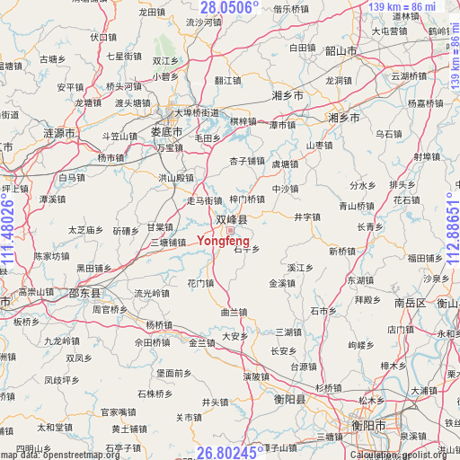
Yongfeng GPS coordinates[2]
27° 25' 41.844" North, 112° 11' 0.168" East
| Map corner | latitude | longitude |
|---|---|---|
| Upper-left | 28.0506°, | 111.48026° |
| Center: | 27.42829°, | 112.18338° |
| Lower-right: | 26.80245°, | 112.88651° |
| Map W x H: | 138.8×138.8 km | = 86.2×86.2mi |
| max Lat: | 53.31946° ⇑76.9% North |
| Yongfeng: | 27.42829° |
| min Lat: | ⇓23.1% South 18.22056° |
| min Long | Yongfeng | max Long |
| 75.07348° | 112.18338° | 134.28917° |
| W 38.3%⇐ | ⇒61.7% E |
Elevation
Elevation of Yongfeng is 118 m = 387 ft, and this is 366.8 m = 1203 ft below average elevation for this country.
| Max E: |
5622 m = 18445 ft | 56.9% |
| Avg. | 484.8 m = 1591 ft | |
| Yongfeng | 118 m = 387 ft | |
Min E: |
-3 m = -10 ft | 43.1% |
See also: Yongfeng elevation on elevation.city.
Geographical zone
Yongfeng is located in North temperate zone (between Tropic of Cancer and the Arctic Circle). Distance of this Northern Tropic circle is 443.8 km =275.8 mi to South.| Distance of | km | miles | from Yongfeng |
|---|---|---|---|
| North Pole | 6957.3 | 4323.1 | to North |
| Arctic Circle | 4351.4 | 2703.8 | to North |
| Tropic Cancer | 443.8 | 275.8 | to South |
| Equator | 3049.7 | 1895 | to South |


Nearby cities:
15 places around Yongfeng: (largest is in red/bold)
• Hengyang
73.8 km =45.9 mi,  144°
144°
• Hongqiao
73.8 km =45.9 mi,  185°
185°
• Huitang
64.1 km =39.8 mi,  13°
13°
• Kaiyun
70.6 km =43.9 mi,  109°
109°
• Laoliangcang
71.9 km =44.7 mi,  0°
0°
• Lengshuijiang
79.7 km =49.5 mi,  291°
291°
• Liangshi
50.5 km =31.4 mi,  240°
240°
• Lianyuan
58.8 km =36.5 mi,  299°
299°
• Longtian
69.9 km =43.4 mi,  339°
339°
• Loudi
38.8 km =24.1 mi,  331°
331°
• Niangxi
75.4 km =46.9 mi,  259°
259°
• Qingtangpu
80.7 km =50.1 mi, 329°
• Xiangxiang
48.4 km =30.1 mi,  45°
45°
• Xiangzikou
78.3 km =48.7 mi, 343°
• Xidu
55.6 km =34.5 mi,  160°
160°
Sources, notices
• [Note1] Compared only with cities in China existing in our database
• [Src1] Map data: © OpenStreetMap contributors (CC-BY-SA)
• [Src2] Other city data from geonames.org with taken over terms of usage.
• [Src3] Geographical zone / Annual Mean Temperature by Robert A. Rohde @ Wikipedia
