Pingyin geodata
Pingyin (Shandong) is a populated place; located in China in Asia/Shanghai (GMT+8) time zone. With population of 62,050 people, there are 696 cities with bigger population in this country. Compared to other cities in China, 77.8% of cities are located further ↓South; 62.7% of cities are located further ←West and 72.7% of cities have higher elevation than Pingyin. Note1


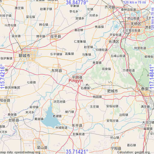
Pingyin GPS coordinates[2]
36° 16' 59.016" North, 116° 26' 43.008" East
| Map corner | latitude | longitude |
|---|---|---|
| Upper-left | 36.84779°, | 115.74216° |
| Center: | 36.28306°, | 116.44528° |
| Lower-right: | 35.71421°, | 117.14841° |
| Map W x H: | 126×126 km | = 78.3×78.3mi |
| max Lat: | 53.31946° ⇑22.2% North |
| Pingyin: | 36.28306° |
| min Lat: | ⇓77.8% South 18.22056° |
| min Long | Pingyin | max Long |
| 75.07348° | 116.44528° | 134.28917° |
| W 62.7%⇐ | ⇒37.3% E |
Elevation
Elevation of Pingyin is 43 m = 141 ft, and this is 441.8 m = 1449 ft below average elevation for this country.
| Max E: |
5622 m = 18445 ft | 72.7% |
| Avg. | 484.8 m = 1591 ft | |
| Pingyin | 43 m = 141 ft | |
Min E: |
-3 m = -10 ft | 27.3% |
See also: Pingyin elevation on elevation.city.
Geographical zone
Pingyin is located in North temperate zone (between Tropic of Cancer and the Arctic Circle). Distance of this Northern Tropic circle is 1428.4 km =887.6 mi to South.| Distance of | km | miles | from Pingyin |
|---|---|---|---|
| North Pole | 5972.8 | 3711.3 | to North |
| Arctic Circle | 3366.9 | 2092.1 | to North |
| Tropic Cancer | 1428.4 | 887.6 | to South |
| Equator | 4034.3 | 2506.8 | to South |


Nearby cities:
15 places around Pingyin: (largest is in red/bold)
• Changqing
39.6 km =24.6 mi,  39°
39°
• Feicheng
29 km =18 mi,  97°
97°
• Gulou
46.7 km =29 mi,  292°
292°
• Jinan
65.3 km =40.6 mi,  49°
49°
• Liaocheng
46.1 km =28.6 mi, 294°
• Nancheng
84.1 km =52.3 mi,  331°
331°
• Ningyang
65.6 km =40.8 mi,  151°
151°
• Tai’an
61.5 km =38.2 mi, 100°
• Wenshang
61.9 km =38.5 mi,  175°
175°
• Yancheng
63.3 km =39.3 mi,  24°
24°
• Yanggu
63.1 km =39.2 mi,  252°
252°
• Yangying
68.3 km =42.4 mi,  220°
220°
• Yanta
69.9 km =43.4 mi,  266°
266°
• Yanzhou
88.2 km =54.8 mi,  156°
156°
• Zhoucheng
42.9 km =26.7 mi,  196°
196°
Sources, notices
• [Note1] Compared only with cities in China existing in our database
• [Src1] Map data: © OpenStreetMap contributors (CC-BY-SA)
• [Src2] Other city data from geonames.org with taken over terms of usage.
• [Src3] Geographical zone / Annual Mean Temperature by Robert A. Rohde @ Wikipedia
