Tiantang geodata
Tiantang (Anhui) is a seat of a third-order administrative division; located in China in Asia/Shanghai (GMT+8) time zone. In our database, there are 1268 cities with bigger population. Compared to other cities in China, 53.4% of cities are located further ↓South; 62.1% of cities are located further ←West and 68% of cities have lower elevation than Tiantang. Note1


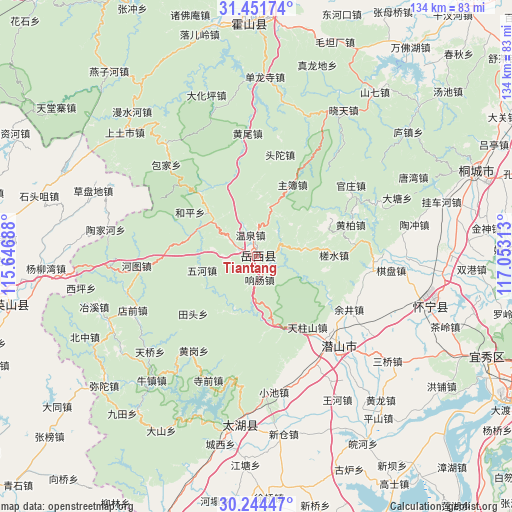
Tiantang GPS coordinates[2]
30° 51' 0" North, 116° 21' 0" East
| Map corner | latitude | longitude |
|---|---|---|
| Upper-left | 31.45174°, | 115.64688° |
| Center: | 30.85°, | 116.35° |
| Lower-right: | 30.24447°, | 117.05313° |
| Map W x H: | 134.2×134.2 km | = 83.4×83.4mi |
| max Lat: | 53.31946° ⇑46.6% North |
| Tiantang: | 30.85° |
| min Lat: | ⇓53.4% South 18.22056° |
| min Long | Tiantang | max Long |
| 75.07348° | 116.35° | 134.28917° |
| W 62.1%⇐ | ⇒37.9% E |
Elevation
Elevation of Tiantang is 376 m = 1234 ft, and this is 108.8 m = 357 ft below average elevation for this country.
| Max E: |
5622 m = 18445 ft | 32% |
| Avg. | 484.8 m = 1591 ft | |
| Tiantang | 376 m = 1234 ft | |
Min E: |
-3 m = -10 ft | 68% |
See also: China elevation on elevation.city.
Geographical zone
Tiantang is located in North temperate zone (between Tropic of Cancer and the Arctic Circle). Distance of this Northern Tropic circle is 824.3 km =512.2 mi to South.| Distance of | km | miles | from Tiantang |
|---|---|---|---|
| North Pole | 6576.9 | 4086.7 | to North |
| Arctic Circle | 3971 | 2467.5 | to North |
| Tropic Cancer | 824.3 | 512.2 | to South |
| Equator | 3430.2 | 2131.4 | to South |


Nearby cities:
15 places around Tiantang: (largest is in red/bold)
• Caodipan
46.3 km =28.8 mi,  291°
291°
• Datong
65.6 km =40.8 mi,  233°
233°
• Gaohe
48.6 km =30.2 mi,  104°
104°
• Hongshan
67.4 km =41.9 mi,  262°
262°
• Jinjiapu
68.3 km =42.4 mi,  273°
273°
• Jinxi
46.8 km =29.1 mi,  186°
186°
• Leijiadian
57.2 km =35.5 mi, 274°
• Meicheng
32.5 km =20.2 mi,  137°
137°
• Quedian
68.6 km =42.6 mi,  42°
42°
• Shitouzui
59.2 km =36.8 mi, 285°
• Tanlin
60.2 km =37.4 mi, 232°
• Taojiahe
40.2 km =25 mi,  280°
280°
• Tongcheng
63.1 km =39.2 mi,  70°
70°
• Wenquan
62.1 km =38.6 mi, 269°
• Yangliuwan
55.3 km =34.4 mi, 266°
Sources, notices
• [Note1] Compared only with cities in China existing in our database
• [Src1] Map data: © OpenStreetMap contributors (CC-BY-SA)
• [Src2] Other city data from geonames.org with taken over terms of usage.
• [Src3] Geographical zone / Annual Mean Temperature by Robert A. Rohde @ Wikipedia
