Laohekou geodata
Laohekou (Hubei) is a populated place; located in China in Asia/Shanghai (GMT+8) time zone. With population of 253,112 people, there are 198 cities with bigger population in this country. Compared to other cities in China, 63.5% of cities are located further ↓South; 64.2% of cities are located further →East and 60.9% of cities have higher elevation than Laohekou. Note1


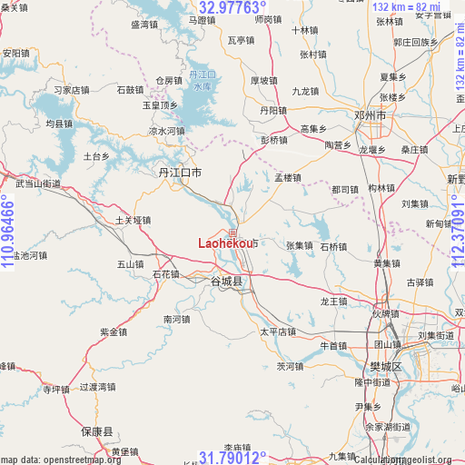
Laohekou GPS coordinates[2]
32° 23' 8.988" North, 111° 40' 4.008" East
| Map corner | latitude | longitude |
|---|---|---|
| Upper-left | 32.97763°, | 110.96466° |
| Center: | 32.38583°, | 111.66778° |
| Lower-right: | 31.79012°, | 112.37091° |
| Map W x H: | 132×132 km | = 82×82mi |
| max Lat: | 53.31946° ⇑36.5% North |
| Laohekou: | 32.38583° |
| min Lat: | ⇓63.5% South 18.22056° |
| min Long | Laohekou | max Long |
| 75.07348° | 111.66778° | 134.28917° |
| W 35.8%⇐ | ⇒64.2% E |
Elevation
Elevation of Laohekou is 93 m = 305 ft, and this is 391.8 m = 1285 ft below average elevation for this country.
| Max E: |
5622 m = 18445 ft | 60.9% |
| Avg. | 484.8 m = 1591 ft | |
| Laohekou | 93 m = 305 ft | |
Min E: |
-3 m = -10 ft | 39.1% |
See also: Laohekou elevation on elevation.city.
Geographical zone
Laohekou is located in North temperate zone (between Tropic of Cancer and the Arctic Circle). Distance of this Northern Tropic circle is 995 km =618.3 mi to South.| Distance of | km | miles | from Laohekou |
|---|---|---|---|
| North Pole | 6406.1 | 3980.6 | to North |
| Arctic Circle | 3800.2 | 2361.3 | to North |
| Tropic Cancer | 995 | 618.3 | to South |
| Equator | 3601 | 2237.6 | to South |


Nearby cities:
15 places around Laohekou: (largest is in red/bold)
• Danjiangkou
23 km =14.3 mi,  319°
319°
• Danzhaolu
22.8 km =14.2 mi, 324°
• Gucheng Chengguanzhen
13.7 km =8.5 mi,  193°
193°
• Hongshanzui
7.7 km =4.8 mi,  354°
354°
• Lengji
7.3 km =4.5 mi,  253°
253°
• Miaotan
28.2 km =17.5 mi,  164°
164°
• Nanhe
27.9 km =17.3 mi,  212°
212°
• Sanguandian
22.4 km =13.9 mi,  309°
309°
• Shihua
23.2 km =14.4 mi,  239°
239°
• Shiqiao
29.1 km =18.1 mi,  97°
97°
• Tuguanya
28.8 km =17.9 mi,  277°
277°
• Wushan
30.5 km =19 mi, 253°
• Xianrendu
15 km =9.3 mi, 163°
• Yuanchong
16.8 km =10.4 mi,  21°
21°
• Zhangji
19.1 km =11.9 mi, 100°
Sources, notices
• [Note1] Compared only with cities in China existing in our database
• [Src1] Map data: © OpenStreetMap contributors (CC-BY-SA)
• [Src2] Other city data from geonames.org with taken over terms of usage.
• [Src3] Geographical zone / Annual Mean Temperature by Robert A. Rohde @ Wikipedia
