Chengxiang geodata
Chengxiang (Sichuan) is a seat of a third-order administrative division; located in China in Asia/Shanghai (GMT+8) time zone. In our database, there are 1268 cities with bigger population. Compared to other cities in China, 69.3% of cities are located further ↑North; 92.6% of cities are located further →East and 93.5% of cities have lower elevation than Chengxiang. Note1


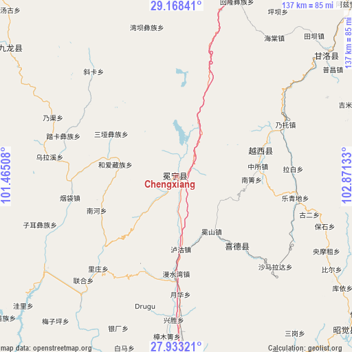
Chengxiang GPS coordinates[2]
28° 33' 9.432" North, 102° 10' 5.52" East
| Map corner | latitude | longitude |
|---|---|---|
| Upper-left | 29.16841°, | 101.46508° |
| Center: | 28.55262°, | 102.1682° |
| Lower-right: | 27.93321°, | 102.87133° |
| Map W x H: | 137.3×137.3 km | = 85.3×85.3mi |
| max Lat: | 53.31946° ⇑69.3% North |
| Chengxiang: | 28.55262° |
| min Lat: | ⇓30.7% South 18.22056° |
| min Long | Chengxiang | max Long |
| 75.07348° | 102.1682° | 134.28917° |
| W 7.4%⇐ | ⇒92.6% E |
Elevation
Elevation of Chengxiang is 1787 m = 5863 ft, and this is 1302.2 m = 4272 ft above average elevation for this country.
| Max E: |
5622 m = 18445 ft | 6.5% |
| Chengxiang | 1787 m 5863 ft | |
| Avg. | 484.8 m = 1591 ft | |
Min E: |
-3 m = -10 ft | 93.5% |
See also: China elevation on elevation.city.
Geographical zone
Chengxiang is located in North temperate zone (between Tropic of Cancer and the Arctic Circle). Distance of this Northern Tropic circle is 568.8 km =353.4 mi to South.| Distance of | km | miles | from Chengxiang |
|---|---|---|---|
| North Pole | 6832.3 | 4245.4 | to North |
| Arctic Circle | 4226.4 | 2626.2 | to North |
| Tropic Cancer | 568.8 | 353.4 | to South |
| Equator | 3174.8 | 1972.7 | to South |


Nearby cities:
15 places around Chengxiang: (largest is in red/bold)
• Dezhou
127.3 km =79.1 mi,  179°
179°
• Guangming
36 km =22.4 mi,  138°
138°
• Hepingyizu
117.8 km =73.2 mi,  49°
49°
• Minjian
138.3 km =85.9 mi,  76°
76°
• Puji
135.4 km =84.1 mi,  164°
164°
• Qiaowa
111.3 km =69.2 mi,  231°
231°
• Shaping
130.8 km =81.3 mi, 54°
• Shirong
100.5 km =62.4 mi,  27°
27°
• Temuli
112.9 km =70.2 mi,  146°
146°
• Xia’er
81.2 km =50.5 mi,  308°
308°
• Xichang
73.6 km =45.7 mi,  172°
172°
• Xincheng
89 km =55.3 mi,  132°
132°
• Xinmian
79 km =49.1 mi,  14°
14°
• Xinshiba
75 km =46.6 mi, 51°
• Yuecheng
34.7 km =21.6 mi,  73°
73°
Sources, notices
• [Note1] Compared only with cities in China existing in our database
• [Src1] Map data: © OpenStreetMap contributors (CC-BY-SA)
• [Src2] Other city data from geonames.org with taken over terms of usage.
• [Src3] Geographical zone / Annual Mean Temperature by Robert A. Rohde @ Wikipedia
