Pingpo geodata
Pingpo (Yunnan) is a seat of a fourth-order administrative division; located in China in Asia/Shanghai (GMT+8) time zone. In our database, there are 1268 cities with bigger population. Compared to other cities in China, 84.6% of cities are located further ↑North; 90.6% of cities are located further →East and 94.4% of cities have lower elevation than Pingpo. Note1


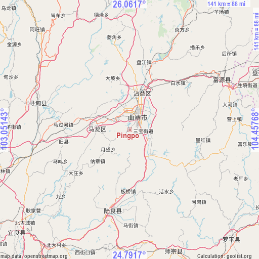
Pingpo GPS coordinates[2]
25° 25' 42.132" North, 103° 45' 16.38" East
| Map corner | latitude | longitude |
|---|---|---|
| Upper-left | 26.0617°, | 103.05143° |
| Center: | 25.42837°, | 103.75455° |
| Lower-right: | 24.7917°, | 104.45768° |
| Map W x H: | 141.2×141.2 km | = 87.7×87.7mi |
| max Lat: | 53.31946° ⇑84.6% North |
| Pingpo: | 25.42837° |
| min Lat: | ⇓15.4% South 18.22056° |
| min Long | Pingpo | max Long |
| 75.07348° | 103.75455° | 134.28917° |
| W 9.4%⇐ | ⇒90.6% E |
Elevation
Elevation of Pingpo is 1920 m = 6299 ft, and this is 1435.2 m = 4709 ft above average elevation for this country.
| Max E: |
5622 m = 18445 ft | 5.6% |
| Pingpo | 1920 m 6299 ft | |
| Avg. | 484.8 m = 1591 ft | |
Min E: |
-3 m = -10 ft | 94.4% |
See also: China elevation on elevation.city.
Geographical zone
Pingpo is located in North temperate zone (between Tropic of Cancer and the Arctic Circle). Distance of this Northern Tropic circle is 221.5 km =137.6 mi to South.| Distance of | km | miles | from Pingpo |
|---|---|---|---|
| North Pole | 7179.7 | 4461.3 | to North |
| Arctic Circle | 4573.8 | 2842 | to North |
| Tropic Cancer | 221.5 | 137.6 | to South |
| Equator | 2827.4 | 1756.9 | to South |


Nearby cities:
15 places around Pingpo: (largest is in red/bold)
• Beidacun Xiaozhai
74.8 km =46.5 mi,  212°
212°
• Beigucheng
75.9 km =47.2 mi,  229°
229°
• Chengfangqiao
37.4 km =23.2 mi,  11°
11°
• Danfeng
71.2 km =44.2 mi,  158°
158°
• Dasongshu
80.8 km =50.2 mi,  347°
347°
• Gaojiacun
36.3 km =22.6 mi,  121°
121°
• Jianxincun
58.5 km =36.4 mi,  38°
38°
• Qujing
6.8 km =4.2 mi,  25°
25°
• Rende
50.1 km =31.1 mi,  286°
286°
• Shilin
80 km =49.7 mi, 212°
• Songyang
73.7 km =45.8 mi,  261°
261°
• Tongquan
19.1 km =11.9 mi, 260°
• Xiping
19.3 km =12 mi, 12°
• Zhongshu
45.5 km =28.3 mi,  191°
191°
• Zhong’an
54.9 km =34.1 mi,  61°
61°
Sources, notices
• [Note1] Compared only with cities in China existing in our database
• [Src1] Map data: © OpenStreetMap contributors (CC-BY-SA)
• [Src2] Other city data from geonames.org with taken over terms of usage.
• [Src3] Geographical zone / Annual Mean Temperature by Robert A. Rohde @ Wikipedia
