Langtang geodata
Langtang (Hunan) is a seat of a fourth-order administrative division; located in China in Asia/Shanghai (GMT+8) time zone. In our database, there are 1268 cities with bigger population. Compared to other cities in China, 74.1% of cities are located further ↑North; 66.5% of cities are located further →East and 53.3% of cities have lower elevation than Langtang. Note1


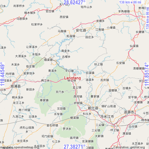
Langtang GPS coordinates[2]
28° 0' 19.008" North, 111° 8' 54.996" East
| Map corner | latitude | longitude |
|---|---|---|
| Upper-left | 28.62427°, | 110.44549° |
| Center: | 28.00528°, | 111.14861° |
| Lower-right: | 27.38271°, | 111.85174° |
| Map W x H: | 138×138.1 km | = 85.7×85.8mi |
| max Lat: | 53.31946° ⇑74.1% North |
| Langtang: | 28.00528° |
| min Lat: | ⇓25.9% South 18.22056° |
| min Long | Langtang | max Long |
| 75.07348° | 111.14861° | 134.28917° |
| W 33.5%⇐ | ⇒66.5% E |
Elevation
Elevation of Langtang is 191 m = 627 ft, and this is 293.8 m = 964 ft below average elevation for this country.
| Max E: |
5622 m = 18445 ft | 46.7% |
| Avg. | 484.8 m = 1591 ft | |
| Langtang | 191 m = 627 ft | |
Min E: |
-3 m = -10 ft | 53.3% |
See also: China elevation on elevation.city.
Geographical zone
Langtang is located in North temperate zone (between Tropic of Cancer and the Arctic Circle). Distance of this Northern Tropic circle is 508 km =315.7 mi to South.| Distance of | km | miles | from Langtang |
|---|---|---|---|
| North Pole | 6893.2 | 4283.2 | to North |
| Arctic Circle | 4287.3 | 2664 | to North |
| Tropic Cancer | 508 | 315.7 | to South |
| Equator | 3113.9 | 1934.9 | to South |


Nearby cities:
15 places around Langtang: (largest is in red/bold)
• Baixi
15.8 km =9.8 mi,  87°
87°
• Cangchang
46.2 km =28.7 mi,  331°
331°
• Dongping
42.1 km =26.2 mi,  7°
7°
• Gangdong
32.4 km =20.1 mi,  252°
252°
• Gulou
18.6 km =11.6 mi,  345°
345°
• Kuixi
41.3 km =25.7 mi,  307°
307°
• Lengshuijiang
44.8 km =27.8 mi,  141°
141°
• Le’an
44.2 km =27.5 mi,  77°
77°
• Liangjiang
28.3 km =17.6 mi,  258°
258°
• Shangmei
32.6 km =20.3 mi,  153°
153°
• Shanxi
19.3 km =12 mi,  278°
278°
• Shuiche
38.3 km =23.8 mi,  202°
202°
• Shuitianzhuang
33.4 km =20.8 mi, 278°
• Xixi
39.6 km =24.6 mi,  208°
208°
• Zhenshang
25.3 km =15.7 mi,  65°
65°
Sources, notices
• [Note1] Compared only with cities in China existing in our database
• [Src1] Map data: © OpenStreetMap contributors (CC-BY-SA)
• [Src2] Other city data from geonames.org with taken over terms of usage.
• [Src3] Geographical zone / Annual Mean Temperature by Robert A. Rohde @ Wikipedia
