Barkam geodata
Barkam (Sichuan) is a seat of a third-order administrative division; located in China in Asia/Shanghai (GMT+8) time zone. In our database, there are 1268 cities with bigger population. Compared to other cities in China, 60.6% of cities are located further ↓South; 92.6% of cities are located further →East and 96.1% of cities have lower elevation than Barkam. Note1


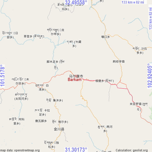
Barkam GPS coordinates[2]
31° 54' 2.124" North, 102° 13' 15.312" East
| Map corner | latitude | longitude |
|---|---|---|
| Upper-left | 32.49558°, | 101.5178° |
| Center: | 31.90059°, | 102.22092° |
| Lower-right: | 31.30173°, | 102.92405° |
| Map W x H: | 132.7×132.7 km | = 82.5×82.5mi |
| max Lat: | 53.31946° ⇑39.4% North |
| Barkam: | 31.90059° |
| min Lat: | ⇓60.6% South 18.22056° |
| min Long | Barkam | max Long |
| 75.07348° | 102.22092° | 134.28917° |
| W 7.4%⇐ | ⇒92.6% E |
Elevation
Elevation of Barkam is 2621 m = 8599 ft, and this is 2136.2 m = 7009 ft above average elevation for this country.
| Max E: |
5622 m = 18445 ft | 3.9% |
| Barkam | 2621 m 8599 ft | |
| Avg. | 484.8 m = 1591 ft | |
Min E: |
-3 m = -10 ft | 96.1% |
See also: China elevation on elevation.city.
Geographical zone
Barkam is located in North temperate zone (between Tropic of Cancer and the Arctic Circle). Distance of this Northern Tropic circle is 941.1 km =584.8 mi to South.| Distance of | km | miles | from Barkam |
|---|---|---|---|
| North Pole | 6460 | 4014.1 | to North |
| Arctic Circle | 3854.2 | 2394.9 | to North |
| Tropic Cancer | 941.1 | 584.8 | to South |
| Equator | 3547 | 2204 | to South |


Nearby cities:
15 places around Barkam: (largest is in red/bold)
• Aba
121.8 km =75.7 mi,  336°
336°
• Hezhi
124.8 km =77.5 mi,  334°
334°
• Jinchuan
49.7 km =30.9 mi,  197°
197°
• Kehe
109.7 km =68.2 mi,  314°
314°
• Kuasha
103 km =64 mi,  320°
320°
• Longcang
125.5 km =78 mi, 337°
• Luhua
74.7 km =46.4 mi,  75°
75°
• Maikun
120.5 km =74.9 mi, 338°
• Meixing
101.1 km =62.8 mi,  172°
172°
• Qiongxi
103.7 km =64.4 mi,  16°
16°
• Rong’an
91.1 km =56.6 mi, 320°
• Se’ergu
113.2 km =70.3 mi,  87°
87°
• Wa’erma
123.1 km =76.5 mi, 337°
• Zagunao
103.6 km =64.4 mi,  119°
119°
• Zhanggu
119 km =73.9 mi, 195°
Sources, notices
• [Note1] Compared only with cities in China existing in our database
• [Src1] Map data: © OpenStreetMap contributors (CC-BY-SA)
• [Src2] Other city data from geonames.org with taken over terms of usage.
• [Src3] Geographical zone / Annual Mean Temperature by Robert A. Rohde @ Wikipedia
