Meixing geodata
Meixing (Sichuan) is a seat of a third-order administrative division; located in China in Asia/Shanghai (GMT+8) time zone. In our database, there are 1268 cities with bigger population. Compared to other cities in China, 54.8% of cities are located further ↓South; 92.5% of cities are located further →East and 95.7% of cities have lower elevation than Meixing. Note1


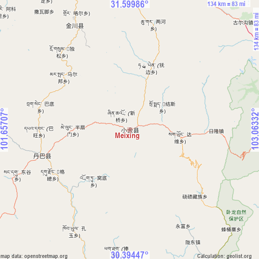
Meixing GPS coordinates[2]
30° 59' 56.652" North, 102° 21' 36.684" East
| Map corner | latitude | longitude |
|---|---|---|
| Upper-left | 31.59986°, | 101.65707° |
| Center: | 30.99907°, | 102.36019° |
| Lower-right: | 30.39447°, | 103.06332° |
| Map W x H: | 134×134 km | = 83.3×83.3mi |
| max Lat: | 53.31946° ⇑45.2% North |
| Meixing: | 30.99907° |
| min Lat: | ⇓54.8% South 18.22056° |
| min Long | Meixing | max Long |
| 75.07348° | 102.36019° | 134.28917° |
| W 7.5%⇐ | ⇒92.5% E |
Elevation
Elevation of Meixing is 2387 m = 7831 ft, and this is 1902.2 m = 6241 ft above average elevation for this country.
| Max E: |
5622 m = 18445 ft | 4.3% |
| Meixing | 2387 m 7831 ft | |
| Avg. | 484.8 m = 1591 ft | |
Min E: |
-3 m = -10 ft | 95.7% |
See also: China elevation on elevation.city.
Geographical zone
Meixing is located in North temperate zone (between Tropic of Cancer and the Arctic Circle). Distance of this Northern Tropic circle is 840.9 km =522.5 mi to South.| Distance of | km | miles | from Meixing |
|---|---|---|---|
| North Pole | 6560.3 | 4076.4 | to North |
| Arctic Circle | 3954.4 | 2457.1 | to North |
| Tropic Cancer | 840.9 | 522.5 | to South |
| Equator | 3446.8 | 2141.7 | to South |


Nearby cities:
15 places around Meixing: (largest is in red/bold)
• Barkam
101.1 km =62.8 mi,  352°
352°
• Guangsheng
128.3 km =79.7 mi,  103°
103°
• Jinchuan
60.2 km =37.4 mi,  331°
331°
• Kangding
117.4 km =72.9 mi,  199°
199°
• Linqiong
123.6 km =76.8 mi,  121°
121°
• Luhua
132.8 km =82.5 mi,  26°
26°
• Luqiao
119.2 km =74.1 mi,  185°
185°
• Muping
82.2 km =51.1 mi,  148°
148°
• Se’ergu
144.9 km =90 mi,  43°
43°
• Weizhou
128.7 km =80 mi,  64°
64°
• Xianshui
117.5 km =73 mi,  269°
269°
• Yucheng
128.3 km =79.7 mi, 151°
• Zagunao
92.2 km =57.3 mi, 57°
• Zhanggu
47.3 km =29.4 mi,  252°
252°
• Zitong
130.5 km =81.1 mi, 102°
Sources, notices
• [Note1] Compared only with cities in China existing in our database
• [Src1] Map data: © OpenStreetMap contributors (CC-BY-SA)
• [Src2] Other city data from geonames.org with taken over terms of usage.
• [Src3] Geographical zone / Annual Mean Temperature by Robert A. Rohde @ Wikipedia
