Dacheng geodata
Dacheng (Guangdong) is a seat of a fourth-order administrative division; located in China in Asia/Urumqi (GMT+6) time zone. In our database, there are 1268 cities with bigger population. Compared to other cities in China, 96.8% of cities are located further ↑North; 66.6% of cities are located further →East and 68.1% of cities have lower elevation than Dacheng. Note1


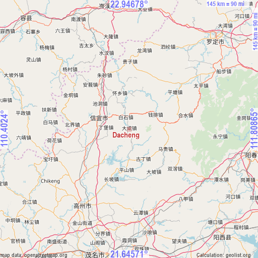
Dacheng GPS coordinates[2]
22° 17' 51.936" North, 111° 6' 19.872" East
| Map corner | latitude | longitude |
|---|---|---|
| Upper-left | 22.94678°, | 110.4024° |
| Center: | 22.29776°, | 111.10552° |
| Lower-right: | 21.64571°, | 111.80865° |
| Map W x H: | 144.7×144.7 km | = 89.9×89.9mi |
| max Lat: | 53.31946° ⇑96.8% North |
| Dacheng: | 22.29776° |
| min Lat: | ⇓3.2% South 18.22056° |
| min Long | Dacheng | max Long |
| 75.07348° | 111.10552° | 134.28917° |
| W 33.4%⇐ | ⇒66.6% E |
Elevation
Elevation of Dacheng is 379 m = 1243 ft, and this is 105.8 m = 347 ft below average elevation for this country.
| Max E: |
5622 m = 18445 ft | 31.9% |
| Avg. | 484.8 m = 1591 ft | |
| Dacheng | 379 m = 1243 ft | |
Min E: |
-3 m = -10 ft | 68.1% |
See also: China elevation on elevation.city.
Geographical zone
Dacheng is located in North Torrid zone (between Equator and Tropic of Cancer). Distance of this Northern Tropic circle is 126.6 km =78.7 mi to North.| Distance of | km | miles | from Dacheng |
|---|---|---|---|
| North Pole | 7527.8 | 4677.6 | to North |
| Arctic Circle | 4921.9 | 3058.3 | to North |
| Tropic Cancer | 126.6 | 78.7 | to North |
| Equator | 2479.3 | 1540.6 | to South |


Nearby cities:
15 places around Dacheng: (largest is in red/bold)
• Baishi
6.8 km =4.2 mi,  349°
349°
• Changpo
27.5 km =17.1 mi,  199°
199°
• Chidong
21.8 km =13.5 mi,  311°
311°
• Dingbao
13.5 km =8.4 mi,  271°
271°
• Dongzhen
19.4 km =12.1 mi,  297°
297°
• Dong’an
24.5 km =15.2 mi,  220°
220°
• Guding
18.7 km =11.6 mi,  149°
149°
• Hongguan
17.6 km =10.9 mi,  13°
13°
• Magui
23.9 km =14.9 mi,  116°
116°
• Pingshan
22.6 km =14 mi,  184°
184°
• Qianpai
17.6 km =10.9 mi,  65°
65°
• Shenzhen
12.9 km =8 mi,  174°
174°
• Shuikou
20.4 km =12.7 mi,  254°
254°
• Xinyi
18.3 km =11.4 mi, 297°
• Zhenlong
25.7 km =16 mi, 248°
Sources, notices
• [Note1] Compared only with cities in China existing in our database
• [Src1] Map data: © OpenStreetMap contributors (CC-BY-SA)
• [Src2] Other city data from geonames.org with taken over terms of usage.
• [Src3] Geographical zone / Annual Mean Temperature by Robert A. Rohde @ Wikipedia
