Xiangjia geodata
Xiangjia (Qinghai) is a seat of a fourth-order administrative division; located in China in Asia/Shanghai (GMT+8) time zone. In our database, there are 1268 cities with bigger population. Compared to other cities in China, 77.1% of cities are located further ↓South; 95.4% of cities are located further →East and 97.1% of cities have lower elevation than Xiangjia. Note1


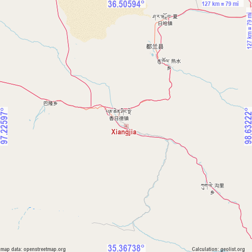
Xiangjia GPS coordinates[2]
35° 56' 19.356" North, 97° 55' 44.724" East
| Map corner | latitude | longitude |
|---|---|---|
| Upper-left | 36.50594°, | 97.22597° |
| Center: | 35.93871°, | 97.92909° |
| Lower-right: | 35.36738°, | 98.63222° |
| Map W x H: | 126.6×126.6 km | = 78.7×78.7mi |
| max Lat: | 53.31946° ⇑22.9% North |
| Xiangjia: | 35.93871° |
| min Lat: | ⇓77.1% South 18.22056° |
| min Long | Xiangjia | max Long |
| 75.07348° | 97.92909° | 134.28917° |
| W 4.6%⇐ | ⇒95.4% E |
Elevation
Elevation of Xiangjia is 3151 m = 10338 ft, and this is 2666.2 m = 8747 ft above average elevation for this country.
| Max E: |
5622 m = 18445 ft | 2.9% |
| Xiangjia | 3151 m 10338 ft | |
| Avg. | 484.8 m = 1591 ft | |
Min E: |
-3 m = -10 ft | 97.1% |
See also: China elevation on elevation.city.
Geographical zone
Xiangjia is located in North temperate zone (between Tropic of Cancer and the Arctic Circle). Distance of this Northern Tropic circle is 1390.1 km =863.8 mi to South.| Distance of | km | miles | from Xiangjia |
|---|---|---|---|
| North Pole | 6011.1 | 3735.1 | to North |
| Arctic Circle | 3405.2 | 2115.9 | to North |
| Tropic Cancer | 1390.1 | 863.8 | to South |
| Equator | 3996 | 2483 | to South |


Nearby cities:
15 places around Xiangjia: (largest is in red/bold)
• Barun
46.2 km =28.7 mi,  268°
268°
• Chaka
139.7 km =86.8 mi,  47°
47°
• Heihe
128.3 km =79.7 mi,  171°
171°
• Huashixia
120.7 km =75 mi,  139°
139°
• Kugri
53.3 km =33.1 mi,  125°
125°
• Machali
115.1 km =71.5 mi, 166°
• Qagan Us
51.5 km =32 mi,  8°
8°
• Reshui
38 km =23.6 mi,  34°
34°
• Serh
119.2 km =74.1 mi,  19°
19°
• Tongpu
126.9 km =78.9 mi, 23°
• Xarag
56.1 km =34.9 mi, 23°
• Xiangride
7.2 km =4.5 mi,  327°
327°
• Xireg
118.3 km =73.5 mi, 22°
• Zhalinghu
94.9 km =59 mi,  181°
181°
• Zongjia
94.7 km =58.8 mi,  291°
291°
Sources, notices
• [Note1] Compared only with cities in China existing in our database
• [Src1] Map data: © OpenStreetMap contributors (CC-BY-SA)
• [Src2] Other city data from geonames.org with taken over terms of usage.
• [Src3] Geographical zone / Annual Mean Temperature by Robert A. Rohde @ Wikipedia
