Zhalinghu geodata
Zhalinghu (Qinghai) is a seat of a fourth-order administrative division; located in China in Asia/Shanghai (GMT+8) time zone. In our database, there are 1268 cities with bigger population. Compared to other cities in China, 75.2% of cities are located further ↓South; 95.5% of cities are located further →East and 99.2% of cities have lower elevation than Zhalinghu. Note1


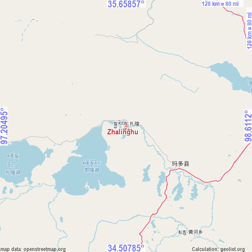
Zhalinghu GPS coordinates[2]
35° 5' 6.864" North, 97° 54' 29.052" East
| Map corner | latitude | longitude |
|---|---|---|
| Upper-left | 35.65857°, | 97.20495° |
| Center: | 35.08524°, | 97.90807° |
| Lower-right: | 34.50785°, | 98.6112° |
| Map W x H: | 127.9×127.9 km | = 79.5×79.5mi |
| max Lat: | 53.31946° ⇑24.8% North |
| Zhalinghu: | 35.08524° |
| min Lat: | ⇓75.2% South 18.22056° |
| min Long | Zhalinghu | max Long |
| 75.07348° | 97.90807° | 134.28917° |
| W 4.5%⇐ | ⇒95.5% E |
Elevation
Elevation of Zhalinghu is 4260 m = 13976 ft, and this is 3775.2 m = 12386 ft above average elevation for this country.
| Max E: |
5622 m = 18445 ft | 0.8% |
| Zhalinghu | 4260 m 13976 ft | |
| Avg. | 484.8 m = 1591 ft | |
Min E: |
-3 m = -10 ft | 99.2% |
See also: China elevation on elevation.city.
Geographical zone
Zhalinghu is located in North temperate zone (between Tropic of Cancer and the Arctic Circle). Distance of this Northern Tropic circle is 1295.2 km =804.8 mi to South.| Distance of | km | miles | from Zhalinghu |
|---|---|---|---|
| North Pole | 6105.9 | 3794 | to North |
| Arctic Circle | 3500.1 | 2174.9 | to North |
| Tropic Cancer | 1295.2 | 804.8 | to South |
| Equator | 3901.1 | 2424 | to South |


Nearby cities:
15 places around Zhalinghu: (largest is in red/bold)
• Barun
103.9 km =64.6 mi,  334°
334°
• Changmahe
134 km =83.3 mi,  119°
119°
• Heihe
37.9 km =23.5 mi,  147°
147°
• Huanghe
68.7 km =42.7 mi, 147°
• Huashixia
81.2 km =50.5 mi,  87°
87°
• Kugri
78.4 km =48.7 mi,  35°
35°
• Machali
34.1 km =21.2 mi, 119°
• Madoi
140 km =87 mi,  267°
267°
• Qagan Us
146.2 km =90.8 mi,  3°
3°
• Reshui
128.4 km =79.8 mi,  10°
10°
• Xarag
148.3 km =92.1 mi, 9°
• Xia Dawo
123.4 km =76.7 mi, 94°
• Xiangjia
94.9 km =59 mi, 1°
• Xiangride
101 km =62.8 mi,  358°
358°
• Youyun
148.1 km =92 mi,  127°
127°
Sources, notices
• [Note1] Compared only with cities in China existing in our database
• [Src1] Map data: © OpenStreetMap contributors (CC-BY-SA)
• [Src2] Other city data from geonames.org with taken over terms of usage.
• [Src3] Geographical zone / Annual Mean Temperature by Robert A. Rohde @ Wikipedia
