Machali geodata
Machali (Qinghai) is a seat of a third-order administrative division; located in China in Asia/Shanghai (GMT+8) time zone. In our database, there are 1268 cities with bigger population. Compared to other cities in China, 74.8% of cities are located further ↓South; 95.4% of cities are located further →East and 99.4% of cities have lower elevation than Machali. Note1


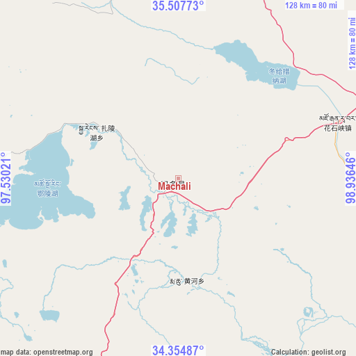
Machali GPS coordinates[2]
34° 55' 59.988" North, 98° 13' 59.988" East
| Map corner | latitude | longitude |
|---|---|---|
| Upper-left | 35.50773°, | 97.53021° |
| Center: | 34.93333°, | 98.23333° |
| Lower-right: | 34.35487°, | 98.93646° |
| Map W x H: | 128.2×128.2 km | = 79.7×79.7mi |
| max Lat: | 53.31946° ⇑25.2% North |
| Machali: | 34.93333° |
| min Lat: | ⇓74.8% South 18.22056° |
| min Long | Machali | max Long |
| 75.07348° | 98.23333° | 134.28917° |
| W 4.6%⇐ | ⇒95.4% E |
Elevation
Elevation of Machali is 4350 m = 14272 ft, and this is 3865.2 m = 12681 ft above average elevation for this country.
| Max E: |
5622 m = 18445 ft | 0.59999999999999% |
| Machali | 4350 m 14272 ft | |
| Avg. | 484.8 m = 1591 ft | |
Min E: |
-3 m = -10 ft | 99.4% |
See also: China elevation on elevation.city.
Geographical zone
Machali is located in North temperate zone (between Tropic of Cancer and the Arctic Circle). Distance of this Northern Tropic circle is 1278.3 km =794.3 mi to South.| Distance of | km | miles | from Machali |
|---|---|---|---|
| North Pole | 6122.8 | 3804.5 | to North |
| Arctic Circle | 3517 | 2185.4 | to North |
| Tropic Cancer | 1278.3 | 794.3 | to South |
| Equator | 3884.2 | 2413.5 | to South |


Nearby cities:
15 places around Machali: (largest is in red/bold)
• Barun
133.2 km =82.8 mi,  326°
326°
• Changmahe
99.9 km =62.1 mi,  119°
119°
• Heihe
17.9 km =11.1 mi,  212°
212°
• Huanghe
41.5 km =25.8 mi,  169°
169°
• Huashixia
55.5 km =34.5 mi,  68°
68°
• Kugri
82.3 km =51.1 mi,  11°
11°
• Reshui
143.2 km =89 mi,  357°
357°
• Tehetu
141.8 km =88.1 mi,  144°
144°
• Wenquan
133.8 km =83.1 mi,  76°
76°
• Xia Dawo
93.9 km =58.3 mi,  85°
85°
• Xiangjia
115.1 km =71.5 mi,  346°
346°
• Xiangride
122 km =75.8 mi, 345°
• Xueshan
137.1 km =85.2 mi,  96°
96°
• Youyun
114.4 km =71.1 mi,  130°
130°
• Zhalinghu
34.1 km =21.2 mi,  299°
299°
Sources, notices
• [Note1] Compared only with cities in China existing in our database
• [Src1] Map data: © OpenStreetMap contributors (CC-BY-SA)
• [Src2] Other city data from geonames.org with taken over terms of usage.
• [Src3] Geographical zone / Annual Mean Temperature by Robert A. Rohde @ Wikipedia
