Anchong geodata
Anchong (Qinghai) is a seat of a fourth-order administrative division; located in China in Asia/Shanghai (GMT+8) time zone. In our database, there are 1268 cities with bigger population. Compared to other cities in China, 67.9% of cities are located further ↓South; 95.7% of cities are located further →East and 98.4% of cities have lower elevation than Anchong. Note1


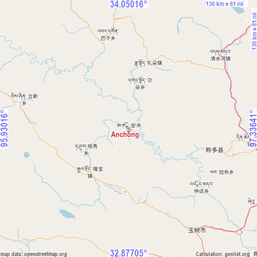
Anchong GPS coordinates[2]
33° 27' 56.124" North, 96° 37' 59.808" East
| Map corner | latitude | longitude |
|---|---|---|
| Upper-left | 34.05016°, | 95.93016° |
| Center: | 33.46559°, | 96.63328° |
| Lower-right: | 32.87705°, | 97.33641° |
| Map W x H: | 130.4×130.4 km | = 81×81mi |
| max Lat: | 53.31946° ⇑32.1% North |
| Anchong: | 33.46559° |
| min Lat: | ⇓67.9% South 18.22056° |
| min Long | Anchong | max Long |
| 75.07348° | 96.63328° | 134.28917° |
| W 4.3%⇐ | ⇒95.7% E |
Elevation
Elevation of Anchong is 3894 m = 12776 ft, and this is 3409.2 m = 11185 ft above average elevation for this country.
| Max E: |
5622 m = 18445 ft | 1.6% |
| Anchong | 3894 m 12776 ft | |
| Avg. | 484.8 m = 1591 ft | |
Min E: |
-3 m = -10 ft | 98.4% |
See also: China elevation on elevation.city.
Geographical zone
Anchong is located in North temperate zone (between Tropic of Cancer and the Arctic Circle). Distance of this Northern Tropic circle is 1115.1 km =692.9 mi to South.| Distance of | km | miles | from Anchong |
|---|---|---|---|
| North Pole | 6286 | 3905.9 | to North |
| Arctic Circle | 3680.1 | 2286.7 | to North |
| Tropic Cancer | 1115.1 | 692.9 | to South |
| Equator | 3721 | 2312.1 | to South |


Nearby cities:
15 places around Anchong: (largest is in red/bold)
• Bagan
49.2 km =30.6 mi,  347°
347°
• Baitang
86.3 km =53.6 mi,  145°
145°
• Dongfeng
78.9 km =49 mi,  331°
331°
• Duocai
118.6 km =73.7 mi,  288°
288°
• Gaduo
24 km =14.9 mi,  14°
14°
• Gyairong
29.3 km =18.2 mi,  222°
222°
• Gyobrag
109.4 km =68 mi,  204°
204°
• Lab
51.9 km =32.2 mi,  114°
114°
• Linxin
55.1 km =34.2 mi, 285°
• Qingshuihe
59.9 km =37.2 mi,  51°
51°
• Shanglaxiu
68.2 km =42.4 mi,  183°
183°
• Xialaxiu
88.8 km =55.2 mi, 181°
• Xiwu
76.1 km =47.3 mi,  119°
119°
• Zadoi
35.3 km =21.9 mi,  16°
16°
• Zhoinda
47.3 km =29.4 mi,  128°
128°
Sources, notices
• [Note1] Compared only with cities in China existing in our database
• [Src1] Map data: © OpenStreetMap contributors (CC-BY-SA)
• [Src2] Other city data from geonames.org with taken over terms of usage.
• [Src3] Geographical zone / Annual Mean Temperature by Robert A. Rohde @ Wikipedia
