Qingshuihe geodata
Qingshuihe (Qinghai) is a seat of a fourth-order administrative division; located in China in Asia/Shanghai (GMT+8) time zone. In our database, there are 1268 cities with bigger population. Compared to other cities in China, 69.3% of cities are located further ↓South; 95.6% of cities are located further →East and 99.4% of cities have lower elevation than Qingshuihe. Note1


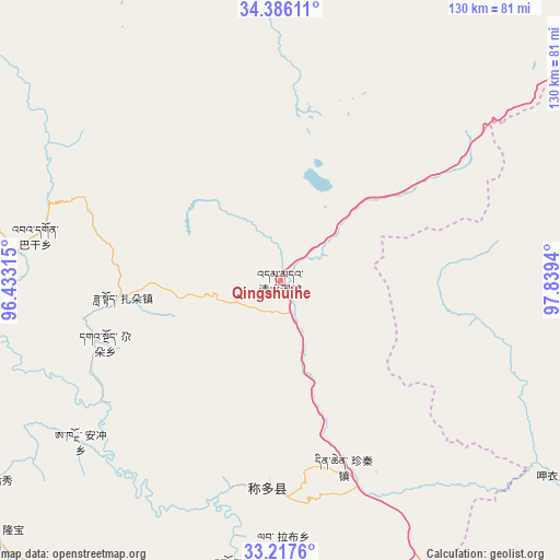
Qingshuihe GPS coordinates[2]
33° 48' 13.86" North, 97° 8' 10.572" East
| Map corner | latitude | longitude |
|---|---|---|
| Upper-left | 34.38611°, | 96.43315° |
| Center: | 33.80385°, | 97.13627° |
| Lower-right: | 33.2176°, | 97.8394° |
| Map W x H: | 129.9×129.9 km | = 80.7×80.7mi |
| max Lat: | 53.31946° ⇑30.7% North |
| Qingshuihe: | 33.80385° |
| min Lat: | ⇓69.3% South 18.22056° |
| min Long | Qingshuihe | max Long |
| 75.07348° | 97.13627° | 134.28917° |
| W 4.4%⇐ | ⇒95.6% E |
Elevation
Elevation of Qingshuihe is 4420 m = 14501 ft, and this is 3935.2 m = 12911 ft above average elevation for this country.
| Max E: |
5622 m = 18445 ft | 0.59999999999999% |
| Qingshuihe | 4420 m 14501 ft | |
| Avg. | 484.8 m = 1591 ft | |
Min E: |
-3 m = -10 ft | 99.4% |
See also: China elevation on elevation.city.
Geographical zone
Qingshuihe is located in North temperate zone (between Tropic of Cancer and the Arctic Circle). Distance of this Northern Tropic circle is 1152.7 km =716.3 mi to South.| Distance of | km | miles | from Qingshuihe |
|---|---|---|---|
| North Pole | 6248.4 | 3882.6 | to North |
| Arctic Circle | 3642.5 | 2263.3 | to North |
| Tropic Cancer | 1152.7 | 716.3 | to South |
| Equator | 3758.6 | 2335.5 | to South |


Nearby cities:
15 places around Qingshuihe: (largest is in red/bold)
• Anchong
59.9 km =37.2 mi,  231°
231°
• Bagan
57.7 km =35.9 mi,  280°
280°
• Baitang
108.9 km =67.7 mi,  179°
179°
• Dongfeng
89.7 km =55.7 mi,  290°
290°
• Gaduo
43.1 km =26.8 mi,  250°
250°
• Gyairong
88.9 km =55.2 mi, 228°
• Huanghe
137.8 km =85.6 mi,  52°
52°
• Lab
59.2 km =36.8 mi, 179°
• Linxin
101.9 km =63.3 mi,  257°
257°
• Qümong
128.1 km =79.6 mi,  135°
135°
• Shanglaxiu
117.4 km =72.9 mi,  205°
205°
• Xialaxiu
135.5 km =84.2 mi,  201°
201°
• Xiwu
77.4 km =48.1 mi,  165°
165°
• Zadoi
36.6 km =22.7 mi, 264°
• Zhoinda
67.9 km =42.2 mi,  188°
188°
Sources, notices
• [Note1] Compared only with cities in China existing in our database
• [Src1] Map data: © OpenStreetMap contributors (CC-BY-SA)
• [Src2] Other city data from geonames.org with taken over terms of usage.
• [Src3] Geographical zone / Annual Mean Temperature by Robert A. Rohde @ Wikipedia
