Gaduo geodata
Gaduo (Qinghai) is a seat of a fourth-order administrative division; located in China in Asia/Shanghai (GMT+8) time zone. In our database, there are 1268 cities with bigger population. Compared to other cities in China, 68.7% of cities are located further ↓South; 95.7% of cities are located further →East and 98.5% of cities have lower elevation than Gaduo. Note1


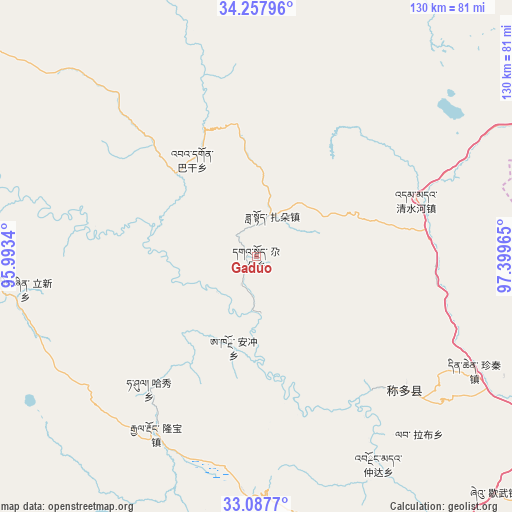
Gaduo GPS coordinates[2]
33° 40' 29.352" North, 96° 41' 47.472" East
| Map corner | latitude | longitude |
|---|---|---|
| Upper-left | 34.25796°, | 95.9934° |
| Center: | 33.67482°, | 96.69652° |
| Lower-right: | 33.0877°, | 97.39965° |
| Map W x H: | 130.1×130.1 km | = 80.8×80.8mi |
| max Lat: | 53.31946° ⇑31.3% North |
| Gaduo: | 33.67482° |
| min Lat: | ⇓68.7% South 18.22056° |
| min Long | Gaduo | max Long |
| 75.07348° | 96.69652° | 134.28917° |
| W 4.3%⇐ | ⇒95.7% E |
Elevation
Elevation of Gaduo is 3948 m = 12953 ft, and this is 3463.2 m = 11362 ft above average elevation for this country.
| Max E: |
5622 m = 18445 ft | 1.5% |
| Gaduo | 3948 m 12953 ft | |
| Avg. | 484.8 m = 1591 ft | |
Min E: |
-3 m = -10 ft | 98.5% |
See also: China elevation on elevation.city.
Geographical zone
Gaduo is located in North temperate zone (between Tropic of Cancer and the Arctic Circle). Distance of this Northern Tropic circle is 1138.4 km =707.4 mi to South.| Distance of | km | miles | from Gaduo |
|---|---|---|---|
| North Pole | 6262.8 | 3891.5 | to North |
| Arctic Circle | 3656.9 | 2272.3 | to North |
| Tropic Cancer | 1138.4 | 707.4 | to South |
| Equator | 3744.3 | 2326.6 | to South |


Nearby cities:
15 places around Gaduo: (largest is in red/bold)
• Anchong
24 km =14.9 mi,  194°
194°
• Bagan
29.6 km =18.4 mi,  326°
326°
• Baitang
103.7 km =64.4 mi,  155°
155°
• Dongfeng
63.3 km =39.3 mi,  316°
316°
• Duocai
118.9 km =73.9 mi,  277°
277°
• Gyairong
51.7 km =32.1 mi,  209°
209°
• Lab
60.9 km =37.8 mi,  137°
137°
• Linxin
59.3 km =36.8 mi,  262°
262°
• Qingshuihe
43.1 km =26.8 mi,  70°
70°
• Shanglaxiu
91.9 km =57.1 mi, 186°
• Xialaxiu
112.3 km =69.8 mi,  184°
184°
• Xiwu
85.5 km =53.1 mi, 135°
• Zadoi
11.3 km =7 mi,  21°
21°
• Zhiqu
130.6 km =81.2 mi,  302°
302°
• Zhoinda
61.2 km =38 mi,  149°
149°
Sources, notices
• [Note1] Compared only with cities in China existing in our database
• [Src1] Map data: © OpenStreetMap contributors (CC-BY-SA)
• [Src2] Other city data from geonames.org with taken over terms of usage.
• [Src3] Geographical zone / Annual Mean Temperature by Robert A. Rohde @ Wikipedia
