Shizi geodata
Shizi (Hubei) is a seat of a fourth-order administrative division; located in China in Asia/Shanghai (GMT+8) time zone. In our database, there are 1268 cities with bigger population. Compared to other cities in China, 50.5% of cities are located further ↑North; 57.6% of cities are located further ←West and 68.7% of cities have higher elevation than Shizi. Note1


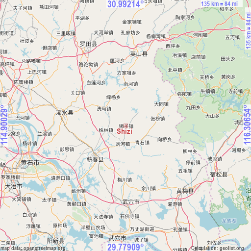
Shizi GPS coordinates[2]
30° 23' 15" North, 115° 36' 12.276" East
| Map corner | latitude | longitude |
|---|---|---|
| Upper-left | 30.99214°, | 114.90029° |
| Center: | 30.3875°, | 115.60341° |
| Lower-right: | 29.77909°, | 116.30654° |
| Map W x H: | 134.9×134.9 km | = 83.8×83.8mi |
| max Lat: | 53.31946° ⇑50.5% North |
| Shizi: | 30.3875° |
| min Lat: | ⇓49.5% South 18.22056° |
| min Long | Shizi | max Long |
| 75.07348° | 115.60341° | 134.28917° |
| W 57.6%⇐ | ⇒42.4% E |
Elevation
Elevation of Shizi is 57 m = 187 ft, and this is 427.8 m = 1404 ft below average elevation for this country.
| Max E: |
5622 m = 18445 ft | 68.7% |
| Avg. | 484.8 m = 1591 ft | |
| Shizi | 57 m = 187 ft | |
Min E: |
-3 m = -10 ft | 31.3% |
See also: China elevation on elevation.city.
Geographical zone
Shizi is located in North temperate zone (between Tropic of Cancer and the Arctic Circle). Distance of this Northern Tropic circle is 772.9 km =480.3 mi to South.| Distance of | km | miles | from Shizi |
|---|---|---|---|
| North Pole | 6628.3 | 4118.6 | to North |
| Arctic Circle | 4022.4 | 2499.4 | to North |
| Tropic Cancer | 772.9 | 480.3 | to South |
| Equator | 3378.8 | 2099.5 | to South |


Nearby cities:
15 places around Shizi: (largest is in red/bold)
• Bailian
27.8 km =17.3 mi,  326°
326°
• Caihe
27.2 km =16.9 mi,  316°
316°
• Caohe
24 km =14.9 mi,  222°
222°
• Datong
22.5 km =14 mi,  57°
57°
• Hengche
24.5 km =15.2 mi,  248°
248°
• Liuhe
10 km =6.2 mi,  193°
193°
• Lüyang
17 km =10.6 mi,  336°
336°
• Nanhe
23 km =14.3 mi,  6°
6°
• Qingshi
12 km =7.5 mi,  135°
135°
• Tanlin
27.9 km =17.3 mi, 57°
• Xiangqiao
15.5 km =9.6 mi,  112°
112°
• Xima
15.4 km =9.6 mi,  306°
306°
• Zhangbang
17.6 km =10.9 mi,  76°
76°
• Zhulin
10.9 km =6.8 mi,  259°
259°
• Zoumaling
25.8 km =16 mi, 221°
Sources, notices
• [Note1] Compared only with cities in China existing in our database
• [Src1] Map data: © OpenStreetMap contributors (CC-BY-SA)
• [Src2] Other city data from geonames.org with taken over terms of usage.
• [Src3] Geographical zone / Annual Mean Temperature by Robert A. Rohde @ Wikipedia
