Longmen geodata
Longmen (Qinghai) is a seat of a fourth-order administrative division; located in China in Asia/Shanghai (GMT+8) time zone. In our database, there are 1268 cities with bigger population. Compared to other cities in China, 80.7% of cities are located further ↓South; 95.1% of cities are located further →East and 99.4% of cities have lower elevation than Longmen. Note1


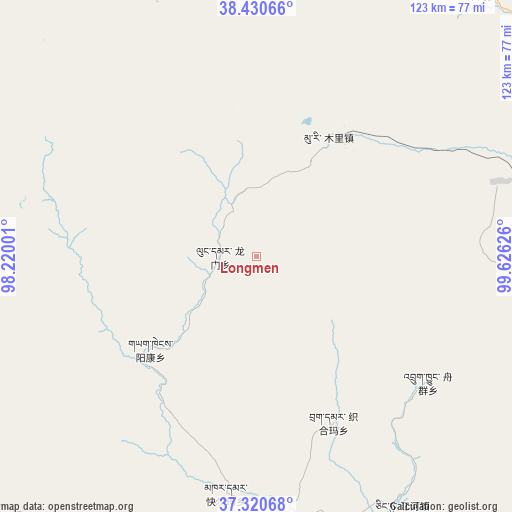
Longmen GPS coordinates[2]
37° 52' 39.936" North, 98° 55' 23.268" East
| Map corner | latitude | longitude |
|---|---|---|
| Upper-left | 38.43066°, | 98.22001° |
| Center: | 37.87776°, | 98.92313° |
| Lower-right: | 37.32068°, | 99.62626° |
| Map W x H: | 123.4×123.4 km | = 76.7×76.7mi |
| max Lat: | 53.31946° ⇑19.3% North |
| Longmen: | 37.87776° |
| min Lat: | ⇓80.7% South 18.22056° |
| min Long | Longmen | max Long |
| 75.07348° | 98.92313° | 134.28917° |
| W 4.9%⇐ | ⇒95.1% E |
Elevation
Elevation of Longmen is 4346 m = 14259 ft, and this is 3861.2 m = 12668 ft above average elevation for this country.
| Max E: |
5622 m = 18445 ft | 0.59999999999999% |
| Longmen | 4346 m 14259 ft | |
| Avg. | 484.8 m = 1591 ft | |
Min E: |
-3 m = -10 ft | 99.4% |
See also: China elevation on elevation.city.
Geographical zone
Longmen is located in North temperate zone (between Tropic of Cancer and the Arctic Circle). Distance of this Northern Tropic circle is 1605.7 km =997.7 mi to South.| Distance of | km | miles | from Longmen |
|---|---|---|---|
| North Pole | 5795.4 | 3601.1 | to North |
| Arctic Circle | 3189.6 | 1981.9 | to North |
| Tropic Cancer | 1605.7 | 997.7 | to South |
| Equator | 4211.6 | 2617 | to South |


Nearby cities:
15 places around Longmen: (largest is in red/bold)
• Jirmeng
98.8 km =61.4 mi,  144°
144°
• Karmar
57.8 km =35.9 mi,  187°
187°
• Kekeli
65.7 km =40.8 mi,  31°
31°
• Muri
31.1 km =19.3 mi,  23°
23°
• Qiecha
114.8 km =71.3 mi,  148°
148°
• Serh
114.1 km =70.9 mi,  205°
205°
• Tongpu
106.2 km =66 mi,  200°
200°
• Xinyuan
64.6 km =40.1 mi,  173°
173°
• Xireg
114.7 km =71.3 mi, 201°
• Xuji
112.6 km =70 mi,  238°
238°
• Yangkang
26.4 km =16.4 mi,  215°
215°
• Yanglong
111.8 km =69.5 mi,  337°
337°
• Yeniugou
80.3 km =49.9 mi,  40°
40°
• Zamashi
102.3 km =63.6 mi,  69°
69°
• Zhugkyung
53.2 km =33.1 mi,  125°
125°
Sources, notices
• [Note1] Compared only with cities in China existing in our database
• [Src1] Map data: © OpenStreetMap contributors (CC-BY-SA)
• [Src2] Other city data from geonames.org with taken over terms of usage.
• [Src3] Geographical zone / Annual Mean Temperature by Robert A. Rohde @ Wikipedia
