Xinyuan geodata
Xinyuan (Qinghai) is a seat of a third-order administrative division; located in China in Asia/Shanghai (GMT+8) time zone. In our database, there are 1268 cities with bigger population. Compared to other cities in China, 79.8% of cities are located further ↓South; 95.1% of cities are located further →East and 97.6% of cities have lower elevation than Xinyuan. Note1


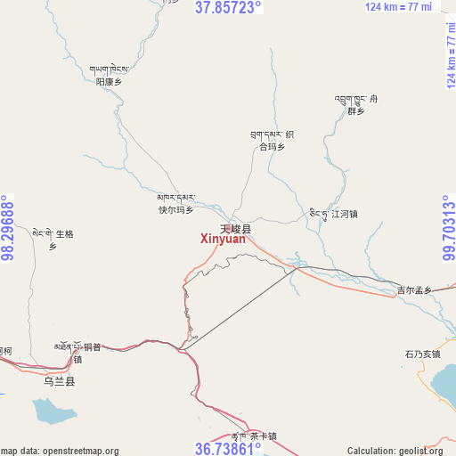
Xinyuan GPS coordinates[2]
37° 18' 0" North, 99° 0' 0" East
| Map corner | latitude | longitude |
|---|---|---|
| Upper-left | 37.85723°, | 98.29688° |
| Center: | 37.3°, | 99° |
| Lower-right: | 36.73861°, | 99.70313° |
| Map W x H: | 124.4×124.4 km | = 77.3×77.3mi |
| max Lat: | 53.31946° ⇑20.2% North |
| Xinyuan: | 37.3° |
| min Lat: | ⇓79.8% South 18.22056° |
| min Long | Xinyuan | max Long |
| 75.07348° | 99° | 134.28917° |
| W 4.9%⇐ | ⇒95.1% E |
Elevation
Elevation of Xinyuan is 3427 m = 11243 ft, and this is 2942.2 m = 9653 ft above average elevation for this country.
| Max E: |
5622 m = 18445 ft | 2.4% |
| Xinyuan | 3427 m 11243 ft | |
| Avg. | 484.8 m = 1591 ft | |
Min E: |
-3 m = -10 ft | 97.6% |
See also: China elevation on elevation.city.
Geographical zone
Xinyuan is located in North temperate zone (between Tropic of Cancer and the Arctic Circle). Distance of this Northern Tropic circle is 1541.5 km =957.8 mi to South.| Distance of | km | miles | from Xinyuan |
|---|---|---|---|
| North Pole | 5859.7 | 3641 | to North |
| Arctic Circle | 3253.8 | 2021.8 | to North |
| Tropic Cancer | 1541.5 | 957.8 | to South |
| Equator | 4147.4 | 2577.1 | to South |


Nearby cities:
15 places around Xinyuan: (largest is in red/bold)
• Chaka
56.8 km =35.3 mi,  173°
173°
• Heimahe
93.7 km =58.2 mi,  132°
132°
• Jirmeng
53 km =32.9 mi,  108°
108°
• Karmar
16.1 km =10 mi,  295°
295°
• Longmen
64.6 km =40.1 mi,  353°
353°
• Muri
92.8 km =57.7 mi,  3°
3°
• Qiecha
63 km =39.1 mi,  122°
122°
• Serh
67.8 km =42.1 mi,  234°
234°
• Shaliuhe
100.4 km =62.4 mi,  88°
88°
• Shinaihai
66 km =41 mi, 122°
• Tongpu
56.6 km =35.2 mi, 231°
• Xireg
65 km =40.4 mi, 229°
• Xuji
103.3 km =64.2 mi,  273°
273°
• Yangkang
48 km =29.8 mi,  332°
332°
• Zhugkyung
49.3 km =30.6 mi,  47°
47°
Sources, notices
• [Note1] Compared only with cities in China existing in our database
• [Src1] Map data: © OpenStreetMap contributors (CC-BY-SA)
• [Src2] Other city data from geonames.org with taken over terms of usage.
• [Src3] Geographical zone / Annual Mean Temperature by Robert A. Rohde @ Wikipedia
