Dongliang’erzhuang geodata
Dongliang’erzhuang (Hebei) is a seat of a fourth-order administrative division; located in China in Asia/Shanghai (GMT+8) time zone. In our database, there are 1268 cities with bigger population. Compared to other cities in China, 78.6% of cities are located further ↓South; 55.6% of cities are located further ←West and 73.7% of cities have higher elevation than Dongliang’erzhuang. Note1


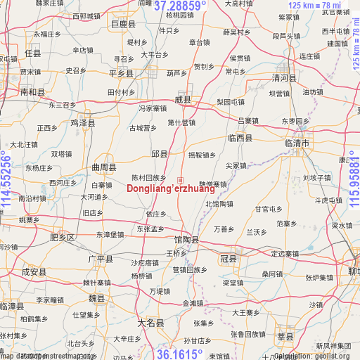
Dongliang’erzhuang GPS coordinates[2]
36° 43' 37.596" North, 115° 15' 20.448" East
| Map corner | latitude | longitude |
|---|---|---|
| Upper-left | 37.28859°, | 114.55256° |
| Center: | 36.72711°, | 115.25568° |
| Lower-right: | 36.1615°, | 115.95881° |
| Map W x H: | 125.3×125.3 km | = 77.9×77.9mi |
| max Lat: | 53.31946° ⇑21.4% North |
| Dongliang’erzhuang: | 36.72711° |
| min Lat: | ⇓78.6% South 18.22056° |
| min Long | Dongliang’erz | max Long |
| 75.07348° | 115.25568° | 134.28917° |
| W 55.6%⇐ | ⇒44.4% E |
Elevation
Elevation of Dongliang’erzhuang is 40 m = 131 ft, and this is 444.8 m = 1459 ft below average elevation for this country.
| Max E: |
5622 m = 18445 ft | 73.7% |
| Avg. | 484.8 m = 1591 ft | |
| Dongliang’erzhuang | 40 m = 131 ft | |
Min E: |
-3 m = -10 ft | 26.3% |
See also: China elevation on elevation.city.
Geographical zone
Dongliang’erzhuang is located in North temperate zone (between Tropic of Cancer and the Arctic Circle). Distance of this Northern Tropic circle is 1477.8 km =918.3 mi to South.| Distance of | km | miles | from Dongliang’erzhuang |
|---|---|---|---|
| North Pole | 5923.4 | 3680.6 | to North |
| Arctic Circle | 3317.5 | 2061.4 | to North |
| Tropic Cancer | 1477.8 | 918.3 | to South |
| Equator | 4083.7 | 2537.5 | to South |


Nearby cities:
15 places around Dongliang’erzhuang: (largest is in red/bold)
• Chensan
10.9 km =6.8 mi,  275°
275°
• Daming
50.1 km =31.1 mi,  191°
191°
• Dongluqiao
9.1 km =5.7 mi,  123°
123°
• Gaobeijie
40.7 km =25.3 mi,  69°
69°
• Guancheng
31.8 km =19.8 mi,  149°
149°
• Guantao
20.8 km =12.9 mi,  173°
173°
• Liuzhuang
55.5 km =34.5 mi,  56°
56°
• Mingzhou
27.7 km =17.2 mi,  0°
0°
• Nancheng
70.5 km =43.8 mi, 69°
• Qiangezhai
28.5 km =17.7 mi,  22°
22°
• Qingnian
42.5 km =26.4 mi, 72°
• Xinmatou
12.6 km =7.8 mi,  323°
323°
• Xiying
31.1 km =19.3 mi, 173°
• Yanta
65.4 km =40.6 mi, 145°
• Youfang
55.6 km =34.5 mi, 55°
Sources, notices
• [Note1] Compared only with cities in China existing in our database
• [Src1] Map data: © OpenStreetMap contributors (CC-BY-SA)
• [Src2] Other city data from geonames.org with taken over terms of usage.
• [Src3] Geographical zone / Annual Mean Temperature by Robert A. Rohde @ Wikipedia
