Baluntaicun geodata
Baluntaicun (Xinjiang) is a populated place; located in China in Asia/Urumqi (GMT+6) time zone. With population of 5,300 people, there are 863 cities with bigger population in this country. Compared to other cities in China, 91.5% of cities are located further ↓South; 98.3% of cities are located further →East and 93.5% of cities have lower elevation than Baluntaicun. Note1


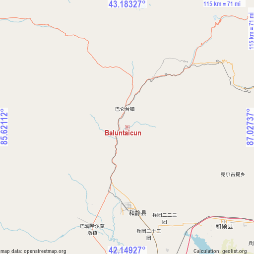
Baluntaicun GPS coordinates[2]
42° 40' 6.312" North, 86° 19' 27.264" East
| Map corner | latitude | longitude |
|---|---|---|
| Upper-left | 43.18327°, | 85.62112° |
| Center: | 42.66842°, | 86.32424° |
| Lower-right: | 42.14927°, | 87.02737° |
| Map W x H: | 115×115 km | = 71.5×71.5mi |
| max Lat: | 53.31946° ⇑8.5% North |
| Baluntaicun: | 42.66842° |
| min Lat: | ⇓91.5% South 18.22056° |
| min Long | Baluntaicun | max Long |
| 75.07348° | 86.32424° | 134.28917° |
| W 1.7%⇐ | ⇒98.3% E |
Elevation
Elevation of Baluntaicun is 1792 m = 5879 ft, and this is 1307.2 m = 4289 ft above average elevation for this country.
| Max E: |
5622 m = 18445 ft | 6.5% |
| Baluntaicun | 1792 m 5879 ft | |
| Avg. | 484.8 m = 1591 ft | |
Min E: |
-3 m = -10 ft | 93.5% |
See also: China elevation on elevation.city.
Geographical zone
Baluntaicun is located in North temperate zone (between Tropic of Cancer and the Arctic Circle). Distance of this Northern Tropic circle is 2138.4 km =1328.7 mi to South.| Distance of | km | miles | from Baluntaicun |
|---|---|---|---|
| North Pole | 5262.8 | 3270.2 | to North |
| Arctic Circle | 2656.9 | 1650.9 | to North |
| Tropic Cancer | 2138.4 | 1328.7 | to South |
| Equator | 4744.3 | 2948 | to South |


Nearby cities:
15 places around Baluntaicun: (largest is in red/bold)
• Bohu
79.9 km =49.6 mi,  162°
162°
• Diwopu
164.5 km =102.2 mi,  34°
34°
• Dongwan
160.8 km =99.9 mi,  344°
344°
• Ewirgol
113.9 km =70.8 mi,  73°
73°
• Hankazi
160.4 km =99.7 mi,  354°
354°
• Hejing
39.4 km =24.5 mi,  173°
173°
• Hoxut
63.2 km =39.3 mi,  136°
136°
• Huoche Xizhan
160.5 km =99.7 mi, 33°
• Korla
101.9 km =63.3 mi,  187°
187°
• Sishilichengzi
79.5 km =49.4 mi, 170°
• Xingfulu
163.3 km =101.5 mi,  40°
40°
• Yangzi Jianglu
160 km =99.4 mi, 39°
• Yanqi
70.3 km =43.7 mi, 163°
• Yuli
148.2 km =92.1 mi,  182°
182°
• Ürümqi
162.9 km =101.2 mi, 39°
Sources, notices
• [Note1] Compared only with cities in China existing in our database
• [Src1] Map data: © OpenStreetMap contributors (CC-BY-SA)
• [Src2] Other city data from geonames.org with taken over terms of usage.
• [Src3] Geographical zone / Annual Mean Temperature by Robert A. Rohde @ Wikipedia
