Sishilichengzi geodata
Sishilichengzi (Xinjiang) is a populated place; located in China in Asia/Urumqi (GMT+6) time zone. With population of 8,722 people, there are 821 cities with bigger population in this country. Compared to other cities in China, 90.9% of cities are located further ↓South; 98.2% of cities are located further →East and 86.2% of cities have lower elevation than Sishilichengzi. Note1


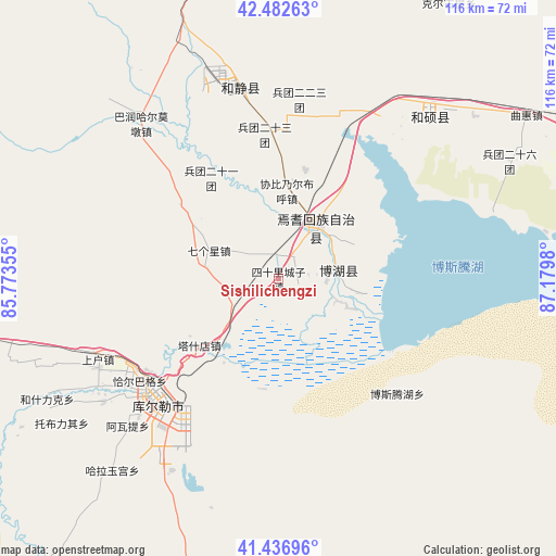
Sishilichengzi GPS coordinates[2]
41° 57' 42.984" North, 86° 28' 36.012" East
| Map corner | latitude | longitude |
|---|---|---|
| Upper-left | 42.48263°, | 85.77355° |
| Center: | 41.96194°, | 86.47667° |
| Lower-right: | 41.43696°, | 87.1798° |
| Map W x H: | 116.3×116.3 km | = 72.3×72.3mi |
| max Lat: | 53.31946° ⇑9.1% North |
| Sishilichengzi: | 41.96194° |
| min Lat: | ⇓90.9% South 18.22056° |
| min Long | Sishilichengzi | max Long |
| 75.07348° | 86.47667° | 134.28917° |
| W 1.8%⇐ | ⇒98.2% E |
Elevation
Elevation of Sishilichengzi is 1057 m = 3468 ft, and this is 572.2 m = 1877 ft above average elevation for this country.
| Max E: |
5622 m = 18445 ft | 13.8% |
| Sishilichengzi | 1057 m 3468 ft | |
| Avg. | 484.8 m = 1591 ft | |
Min E: |
-3 m = -10 ft | 86.2% |
See also: China elevation on elevation.city.
Geographical zone
Sishilichengzi is located in North temperate zone (between Tropic of Cancer and the Arctic Circle). Distance of this Northern Tropic circle is 2059.8 km =1279.9 mi to South.| Distance of | km | miles | from Sishilichengzi |
|---|---|---|---|
| North Pole | 5341.3 | 3318.9 | to North |
| Arctic Circle | 2735.4 | 1699.7 | to North |
| Tropic Cancer | 2059.8 | 1279.9 | to South |
| Equator | 4665.7 | 2899.1 | to South |


Nearby cities:
15 places around Sishilichengzi: (largest is in red/bold)
• Baluntaicun
79.5 km =49.4 mi,  350°
350°
• Bohu
12.3 km =7.6 mi,  78°
78°
• Dabancheng
216.4 km =134.5 mi,  44°
44°
• Ewirgol
147.9 km =91.9 mi, 41°
• Hejing
40.2 km =25 mi, 348°
• Hoxut
45.6 km =28.3 mi, 43°
• Huoche Xizhan
225.8 km =140.3 mi,  19°
19°
• Korla
35 km =21.7 mi,  230°
230°
• Luntai
186 km =115.6 mi,  263°
263°
• Toksun
200.4 km =124.5 mi,  62°
62°
• Xingfulu
223.4 km =138.8 mi,  25°
25°
• Yangzi Jianglu
220.9 km =137.3 mi, 24°
• Yanqi
13.4 km =8.3 mi, 33°
• Yuli
71.9 km =44.7 mi,  194°
194°
• Ürümqi
224 km =139.2 mi, 24°
Sources, notices
• [Note1] Compared only with cities in China existing in our database
• [Src1] Map data: © OpenStreetMap contributors (CC-BY-SA)
• [Src2] Other city data from geonames.org with taken over terms of usage.
• [Src3] Geographical zone / Annual Mean Temperature by Robert A. Rohde @ Wikipedia
