Zito geodata
Zito (Tibet) is a seat of a third-order administrative division; located in China in Asia/Shanghai (GMT+8) time zone. In our database, there are 1268 cities with bigger population. Compared to other cities in China, 52.4% of cities are located further ↓South; 95.9% of cities are located further →East and 98.1% of cities have lower elevation than Zito. Note1


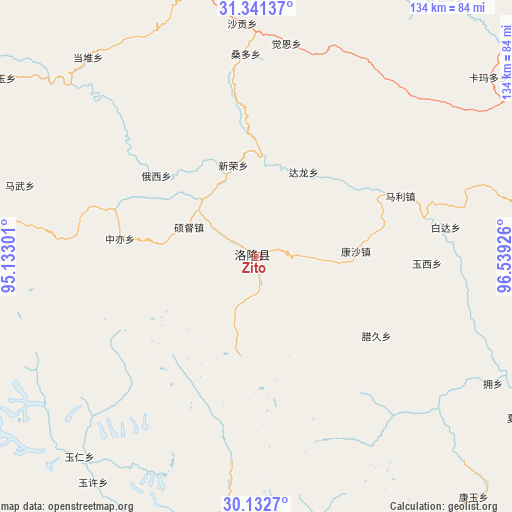
Zito GPS coordinates[2]
30° 44' 20.148" North, 95° 50' 10.068" East
| Map corner | latitude | longitude |
|---|---|---|
| Upper-left | 31.34137°, | 95.13301° |
| Center: | 30.73893°, | 95.83613° |
| Lower-right: | 30.1327°, | 96.53926° |
| Map W x H: | 134.4×134.4 km | = 83.5×83.5mi |
| max Lat: | 53.31946° ⇑47.6% North |
| Zito: | 30.73893° |
| min Lat: | ⇓52.4% South 18.22056° |
| min Long | Zito | max Long |
| 75.07348° | 95.83613° | 134.28917° |
| W 4.1%⇐ | ⇒95.9% E |
Elevation
Elevation of Zito is 3728 m = 12231 ft, and this is 3243.2 m = 10640 ft above average elevation for this country.
| Max E: |
5622 m = 18445 ft | 1.9% |
| Zito | 3728 m 12231 ft | |
| Avg. | 484.8 m = 1591 ft | |
Min E: |
-3 m = -10 ft | 98.1% |
See also: China elevation on elevation.city.
Geographical zone
Zito is located in North temperate zone (between Tropic of Cancer and the Arctic Circle). Distance of this Northern Tropic circle is 811.9 km =504.5 mi to South.| Distance of | km | miles | from Zito |
|---|---|---|---|
| North Pole | 6589.2 | 4094.3 | to North |
| Arctic Circle | 3983.3 | 2475.1 | to North |
| Tropic Cancer | 811.9 | 504.5 | to South |
| Equator | 3417.8 | 2123.7 | to South |


Nearby cities:
15 places around Zito: (largest is in red/bold)
• Baima
128.5 km =79.8 mi,  126°
126°
• Banbar
96 km =59.7 mi,  276°
276°
• Coka
112.9 km =70.2 mi, 279°
• Dingqing
78.5 km =48.8 mi,  342°
342°
• Domartang
111.7 km =69.4 mi, 281°
• Garmo
105.1 km =65.3 mi,  303°
303°
• Gyamotang
96.3 km =59.8 mi, 336°
• Marxog
115.7 km =71.9 mi, 283°
• Mawu
64.6 km =40.1 mi,  287°
287°
• Racaka
98 km =60.9 mi,  41°
41°
• Reyu
81.7 km =50.8 mi, 304°
• Samdo
89.9 km =55.9 mi,  54°
54°
• Towa
92.3 km =57.4 mi, 288°
• Xiexiong
77.4 km =48.1 mi, 344°
• Zhamog
97.3 km =60.5 mi,  184°
184°
Sources, notices
• [Note1] Compared only with cities in China existing in our database
• [Src1] Map data: © OpenStreetMap contributors (CC-BY-SA)
• [Src2] Other city data from geonames.org with taken over terms of usage.
• [Src3] Geographical zone / Annual Mean Temperature by Robert A. Rohde @ Wikipedia
