Samdo geodata
Samdo (Tibet) is a seat of a third-order administrative division; located in China in Asia/Shanghai (GMT+8) time zone. In our database, there are 1268 cities with bigger population. Compared to other cities in China, 56.4% of cities are located further ↓South; 95.7% of cities are located further →East and 98.2% of cities have lower elevation than Samdo. Note1


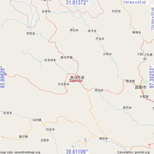
Samdo GPS coordinates[2]
31° 12' 51.48" North, 96° 35' 57.84" East
| Map corner | latitude | longitude |
|---|---|---|
| Upper-left | 31.81372°, | 95.89628° |
| Center: | 31.2143°, | 96.5994° |
| Lower-right: | 30.61106°, | 97.30253° |
| Map W x H: | 133.7×133.7 km | = 83.1×83.1mi |
| max Lat: | 53.31946° ⇑43.6% North |
| Samdo: | 31.2143° |
| min Lat: | ⇓56.4% South 18.22056° |
| min Long | Samdo | max Long |
| 75.07348° | 96.5994° | 134.28917° |
| W 4.3%⇐ | ⇒95.7% E |
Elevation
Elevation of Samdo is 3802 m = 12474 ft, and this is 3317.2 m = 10883 ft above average elevation for this country.
| Max E: |
5622 m = 18445 ft | 1.8% |
| Samdo | 3802 m 12474 ft | |
| Avg. | 484.8 m = 1591 ft | |
Min E: |
-3 m = -10 ft | 98.2% |
See also: China elevation on elevation.city.
Geographical zone
Samdo is located in North temperate zone (between Tropic of Cancer and the Arctic Circle). Distance of this Northern Tropic circle is 864.8 km =537.4 mi to South.| Distance of | km | miles | from Samdo |
|---|---|---|---|
| North Pole | 6536.4 | 4061.5 | to North |
| Arctic Circle | 3930.5 | 2442.3 | to North |
| Tropic Cancer | 864.8 | 537.4 | to South |
| Equator | 3470.7 | 2156.6 | to South |


Nearby cities:
15 places around Samdo: (largest is in red/bold)
• Baima
132.2 km =82.1 mi,  166°
166°
• Dingqing
98.9 km =61.5 mi,  282°
282°
• Gaxung
130.2 km =80.9 mi,  316°
316°
• Gyamotang
116.2 km =72.2 mi,  287°
287°
• Jinisai
110.3 km =68.5 mi,  329°
329°
• Jiqu
93.7 km =58.2 mi, 330°
• Mozhong
119.2 km =74.1 mi,  10°
10°
• Nyagla
94.8 km =58.9 mi, 13°
• Qamdo
56 km =34.8 mi,  99°
99°
• Qiezha
96.1 km =59.7 mi,  355°
355°
• Racaka
22.1 km =13.7 mi,  339°
339°
• Xangda
110.8 km =68.8 mi,  354°
354°
• Xiexiong
95.5 km =59.3 mi, 283°
• Yanduo
111.6 km =69.3 mi,  123°
123°
• Zito
89.9 km =55.9 mi,  234°
234°
Sources, notices
• [Note1] Compared only with cities in China existing in our database
• [Src1] Map data: © OpenStreetMap contributors (CC-BY-SA)
• [Src2] Other city data from geonames.org with taken over terms of usage.
• [Src3] Geographical zone / Annual Mean Temperature by Robert A. Rohde @ Wikipedia
