Puerto Yuca geodata
Puerto Yuca (Meta) is a populated place; located in Colombia in America/Bogota (GMT-5) time zone. With population of 5,029 people, there are 506 cities with bigger population in this country. Compared to other cities in Colombia, 84.7% of cities are located further ↑North; 82.7% of cities are located further ←West and 73.8% of cities have higher elevation than Puerto Yuca. Note1


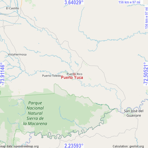
Puerto Yuca GPS coordinates[2]
2° 56' 17.988" North, 73° 12' 29.988" West
| Map corner | latitude | longitude |
|---|---|---|
| Upper-left | 3.64029°, | -73.91146° |
| Center: | 2.93833°, | -73.20833° |
| Lower-right: | 2.23593°, | -72.50521° |
| Map W x H: | 156.2×156.2 km | = 97.1×97.1mi |
| max Lat: | 13.38166° ⇑84.7% North |
| Puerto Yuca: | 2.93833° |
| min Lat: | ⇓15.3% South -4.21528° |
| min Long | Puerto Yuca | max Long |
| -81.70636° | -73.20833° | -67.06996° |
| W 82.7%⇐ | ⇒17.3% E |
Elevation
Elevation of Puerto Yuca is 212 m = 696 ft, and this is 937.3 m = 3075 ft below average elevation for this country.
| Max E: |
3342 m = 10965 ft | 73.8% |
| Avg. | 1149.3 m = 3771 ft | |
| Puerto Yuca | 212 m = 696 ft | |
Min E: |
1 m = 3 ft | 26.2% |
See also: Colombia elevation on elevation.city.
Geographical zone
Puerto Yuca is located in North Torrid zone (between Equator and Tropic of Cancer). Distance of Equator is 326.7 km =203 mi to South.| Distance of | km | miles | from Puerto Yuca |
|---|---|---|---|
| North Pole | 9680.4 | 6015.1 | to North |
| Arctic Circle | 7074.5 | 4395.9 | to North |
| Tropic Cancer | 2279.2 | 1416.2 | to North |
| Equator | 326.7 | 203 | to South |


Nearby cities:
15 places around Puerto Yuca: (largest is in red/bold)
• El Castillo
95.3 km =59.2 mi,  316°
316°
• El Dorado
41.9 km =26 mi,  115°
115°
• El Retorno
93.4 km =58 mi,  136°
136°
• Fuente de Oro
74.2 km =46.1 mi, 321°
• Granada
87.4 km =54.3 mi, 320°
• La Macarena
105.8 km =65.7 mi,  217°
217°
• Mesetas
105.2 km =65.4 mi,  298°
298°
• Puerto Concordia
61.2 km =38 mi,  125°
125°
• Puerto Lleras
23.7 km =14.7 mi,  293°
293°
• Puerto Lleras
41.2 km =25.6 mi,  333°
333°
• San Carlos de Guaroa
86.1 km =53.5 mi,  357°
357°
• San José del Guaviare
74.5 km =46.3 mi, 123°
• San Juan de Arama
88 km =54.7 mi, 303°
• San Martín
100.4 km =62.4 mi, 327°
• Vistahermosa
63.8 km =39.6 mi, 288°
Sources, notices
• [Note1] Compared only with cities in Colombia existing in our database
• [Src1] Map data: © OpenStreetMap contributors (CC-BY-SA)
• [Src2] Other city data from geonames.org with taken over terms of usage.
• [Src3] Geographical zone / Annual Mean Temperature by Robert A. Rohde @ Wikipedia
