San Carlos de Guaroa geodata
San Carlos de Guaroa (Meta) is a seat of a second-order administrative division; located in Colombia in America/Bogota (GMT-5) time zone. With population of 1,604 people, there are 853 cities with bigger population in this country. Compared to other cities in Colombia, 80.2% of cities are located further ↑North; 81.9% of cities are located further ←West and 73.4% of cities have higher elevation than San Carlos de Guaroa. Note1
Current local time in San Carlos de Guaroa:
08:10 AM, WednesdayDifference from your time zone: hours


San Carlos de Guaroa GPS coordinates[2]
3° 42' 41.796" North, 73° 14' 36.384" West
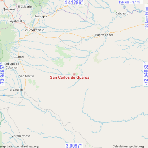
| Map corner | latitude | longitude |
|---|---|---|
| Upper-left | 4.41296°, | -73.94657° |
| Center: | 3.71161°, | -73.24344° |
| Lower-right: | 3.0097°, | -72.54032° |
| Map W x H: | 156×156 km | = 96.9×96.9mi |
| max Lat: | 13.38166° ⇑80.2% North |
| San Carlos de Guaroa: | 3.71161° |
| min Lat: | ⇓19.8% South -4.21528° |
| min Long | San Carlos de G | max Long |
| -81.70636° | -73.24344° | -67.06996° |
| W 81.9%⇐ | ⇒18.1% E |
Elevation
Elevation of San Carlos de Guaroa is 224 m = 735 ft, and this is 925.3 m = 3036 ft below average elevation for this country.
| Max E: |
3342 m = 10965 ft | 73.4% |
| Avg. | 1149.3 m = 3771 ft | |
| San Carlos de Guaroa | 224 m = 735 ft | |
Min E: |
1 m = 3 ft | 26.6% |
See also: Colombia elevation on elevation.city.
Geographical zone
San Carlos de Guaroa is located in North Torrid zone (between Equator and Tropic of Cancer). Distance of Equator is 412.7 km =256.4 mi to South.| Distance of | km | miles | from San Carlos de Guaroa |
|---|---|---|---|
| North Pole | 9594.4 | 5961.7 | to North |
| Arctic Circle | 6988.5 | 4342.5 | to North |
| Tropic Cancer | 2193.2 | 1362.8 | to North |
| Equator | 412.7 | 256.4 | to South |


Nearby cities:
15 places around San Carlos de Guaroa: (largest is in red/bold)
• Acacías
64.8 km =40.3 mi,  298°
298°
• Castilla La Nueva
51 km =31.7 mi,  284°
284°
• Cubarral
66.9 km =41.6 mi, 278°
• Cumaral
67.8 km =42.1 mi,  336°
336°
• El Castillo
63.4 km =39.4 mi,  254°
254°
• El Dorado
65.7 km =40.8 mi,  272°
272°
• Fuente de Oro
50.3 km =31.3 mi,  236°
236°
• Granada
54.6 km =33.9 mi, 250°
• Guamal
60.9 km =37.8 mi,  287°
287°
• Paratebueno
73.9 km =45.9 mi,  2°
2°
• Puerto Lleras
51.3 km =31.9 mi,  196°
196°
• Puerto López
53.6 km =33.3 mi,  36°
36°
• Restrepo
70.3 km =43.7 mi,  329°
329°
• San Martín
50.6 km =31.4 mi, 268°
• Villavicencio
64 km =39.8 mi,  318°
318°
Sources, notices
• [Note1] Compared only with cities in Colombia existing in our database
• [Src1] Map data: © OpenStreetMap contributors (CC-BY-SA)
• [Src2] Other city data from geonames.org with taken over terms of usage.
• [Src3] Geographical zone / Annual Mean Temperature by Robert A. Rohde @ Wikipedia
