San José del Guaviare geodata
San José del Guaviare (Guaviare) is a seat of a first-order administrative division; located in Colombia in America/Bogota (GMT-5) time zone. With population of 22,136 people, there are 164 cities with bigger population in this country. Compared to other cities in Colombia, 86.5% of cities are located further ↑North; 93.6% of cities are located further ←West and 75% of cities have higher elevation than San José del Guaviare. Note1


San José del Guaviare GPS coordinates[2]
2° 34' 22.296" North, 72° 38' 45.276" West
| Map corner | latitude | longitude |
|---|---|---|
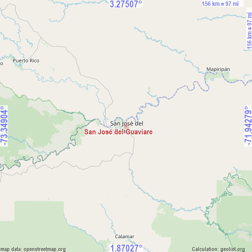
| Upper-left | 3.27507°, | -73.34904° |
| Center: | 2.57286°, | -72.64591° |
| Lower-right: | 1.87027°, | -71.94279° |
| Map W x H: | 156.2×156.2 km | = 97.1×97.1mi |
| max Lat: | 13.38166° ⇑86.5% North |
| San José del Guaviare: | 2.57286° |
| min Lat: | ⇓13.5% South -4.21528° |
| min Long | San José del G | max Long |
| -81.70636° | -72.64591° | -67.06996° |
| W 93.6%⇐ | ⇒6.4% E |
Elevation
Elevation of San José del Guaviare is 184 m = 604 ft, and this is 965.3 m = 3167 ft below average elevation for this country.
| Max E: |
3342 m = 10965 ft | 75% |
| Avg. | 1149.3 m = 3771 ft | |
| San José del Guaviare | 184 m = 604 ft | |
Min E: |
1 m = 3 ft | 25% |
See also: Colombia elevation on elevation.city.
Geographical zone
San José del Guaviare is located in North Torrid zone (between Equator and Tropic of Cancer). Distance of Equator is 286.1 km =177.8 mi to South.| Distance of | km | miles | from San José del Guaviare |
|---|---|---|---|
| North Pole | 9721 | 6040.3 | to North |
| Arctic Circle | 7115.1 | 4421.1 | to North |
| Tropic Cancer | 2319.8 | 1441.5 | to North |
| Equator | 286.1 | 177.8 | to South |


Nearby cities:
15 places around San José del Guaviare: (largest is in red/bold)
• Calamar
68.2 km =42.4 mi,  180°
180°
• El Dorado
33.3 km =20.7 mi,  312°
312°
• El Retorno
27.1 km =16.8 mi, 175°
• Fuente de Oro
146.7 km =91.2 mi, 312°
• Granada
160 km =99.4 mi, 312°
• La Macarena
134 km =83.3 mi,  251°
251°
• Mapiripán
67 km =41.6 mi,  58°
58°
• Miraflores
157.7 km =98 mi,  150°
150°
• Puerto Concordia
13.5 km =8.4 mi,  293°
293°
• Puerto Lleras
97.9 km =60.8 mi,  300°
300°
• Puerto Lleras
112.1 km =69.7 mi, 313°
• Puerto Yuca
74.5 km =46.3 mi, 303°
• San Carlos de Guaroa
142.9 km =88.8 mi,  332°
332°
• San Juan de Arama
162.5 km =101 mi, 303°
• Vistahermosa
137.2 km =85.3 mi, 296°
Sources, notices
• [Note1] Compared only with cities in Colombia existing in our database
• [Src1] Map data: © OpenStreetMap contributors (CC-BY-SA)
• [Src2] Other city data from geonames.org with taken over terms of usage.
• [Src3] Geographical zone / Annual Mean Temperature by Robert A. Rohde @ Wikipedia
