Puerto Boyacá geodata
Puerto Boyacá (Boyacá) is a seat of a second-order administrative division; located in Colombia in America/Bogota (GMT-5) time zone. With population of 27,310 people, there are 134 cities with bigger population in this country. Compared to other cities in Colombia, 58.9% of cities are located further ↓South; 55.3% of cities are located further ←West and 77.8% of cities have higher elevation than Puerto Boyacá. Note1


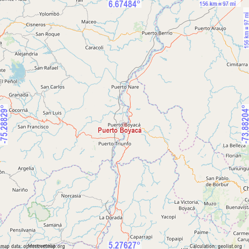
Puerto Boyacá GPS coordinates[2]
5° 58' 33.6" North, 74° 35' 6.576" West
| Map corner | latitude | longitude |
|---|---|---|
| Upper-left | 6.67484°, | -75.28829° |
| Center: | 5.976°, | -74.58516° |
| Lower-right: | 5.27627°, | -73.88204° |
| Map W x H: | 155.5×155.5 km | = 96.6×96.6mi |
| max Lat: | 13.38166° ⇑41.1% North |
| Puerto Boyacá: | 5.976° |
| min Lat: | ⇓58.9% South -4.21528° |
| min Long | Puerto Boyacá | max Long |
| -81.70636° | -74.58516° | -67.06996° |
| W 55.3%⇐ | ⇒44.7% E |
Elevation
Elevation of Puerto Boyacá is 142 m = 466 ft, and this is 1007.3 m = 3305 ft below average elevation for this country.
| Max E: |
3342 m = 10965 ft | 77.8% |
| Avg. | 1149.3 m = 3771 ft | |
| Puerto Boyacá | 142 m = 466 ft | |
Min E: |
1 m = 3 ft | 22.2% |
See also: Colombia elevation on elevation.city.
Geographical zone
Puerto Boyacá is located in North Torrid zone (between Equator and Tropic of Cancer). Distance of Equator is 664.5 km =412.9 mi to South.| Distance of | km | miles | from Puerto Boyacá |
|---|---|---|---|
| North Pole | 9342.6 | 5805.2 | to North |
| Arctic Circle | 6736.7 | 4186 | to North |
| Tropic Cancer | 1941.5 | 1206.4 | to North |
| Equator | 664.5 | 412.9 | to South |


Nearby cities:
15 places around Puerto Boyacá: (largest is in red/bold)
• Caracolí
51.8 km =32.2 mi,  338°
338°
• Cocorná
67 km =41.6 mi,  277°
277°
• El Carmen
64.8 km =40.3 mi,  261°
261°
• La Dorada
59.4 km =36.9 mi,  188°
188°
• La Victoria
63.2 km =39.3 mi,  142°
142°
• Norcasia
55.8 km =34.7 mi,  216°
216°
• Otanche
57 km =35.4 mi,  128°
128°
• Puerto Berrío
60.7 km =37.7 mi,  19°
19°
• Puerto Salgar
57.5 km =35.7 mi, 187°
• Puerto Triunfo
13 km =8.1 mi,  208°
208°
• San Carlos
50.9 km =31.6 mi,  297°
297°
• San Francisco
57.1 km =35.5 mi,  268°
268°
• San Luis
45.8 km =28.5 mi, 279°
• San Rafael
60.2 km =37.4 mi,  305°
305°
• Yacopí
63.6 km =39.5 mi,  154°
154°
Sources, notices
• [Note1] Compared only with cities in Colombia existing in our database
• [Src1] Map data: © OpenStreetMap contributors (CC-BY-SA)
• [Src2] Other city data from geonames.org with taken over terms of usage.
• [Src3] Geographical zone / Annual Mean Temperature by Robert A. Rohde @ Wikipedia
