Mitú geodata
Mitú (Vaupés) is a seat of a first-order administrative division; located in Colombia in America/Bogota (GMT-5) time zone. With population of 5,917 people, there are 455 cities with bigger population in this country. Compared to other cities in Colombia, 95.6% of cities are located further ↑North; 99.4% of cities are located further ←West and 75.7% of cities have higher elevation than Mitú. Note1


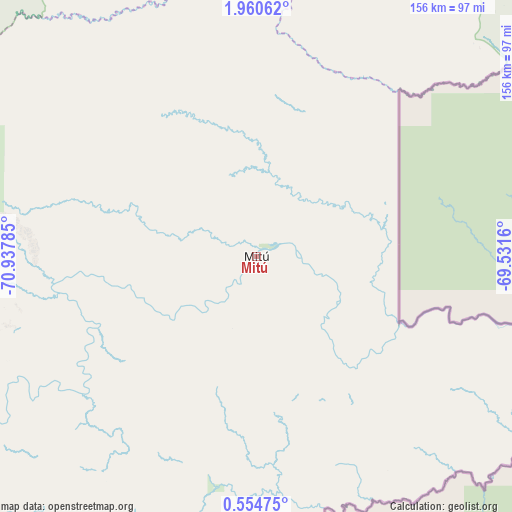
Mitú GPS coordinates[2]
1° 15' 28.008" North, 70° 14' 4.992" West
| Map corner | latitude | longitude |
|---|---|---|
| Upper-left | 1.96062°, | -70.93785° |
| Center: | 1.25778°, | -70.23472° |
| Lower-right: | 0.55475°, | -69.5316° |
| Map W x H: | 156.3×156.3 km | = 97.1×97.1mi |
| max Lat: | 13.38166° ⇑95.6% North |
| Mitú: | 1.25778° |
| min Lat: | ⇓4.4% South -4.21528° |
| min Long | Mitú | max Long |
| -81.70636° | -70.23472° | -67.06996° |
| W 99.4%⇐ | ⇒0.59999999999999% E |
Elevation
Elevation of Mitú is 174 m = 571 ft, and this is 975.3 m = 3200 ft below average elevation for this country.
| Max E: |
3342 m = 10965 ft | 75.7% |
| Avg. | 1149.3 m = 3771 ft | |
| Mitú | 174 m = 571 ft | |
Min E: |
1 m = 3 ft | 24.3% |
See also: Colombia elevation on elevation.city.
Geographical zone
Mitú is located in North Torrid zone (between Equator and Tropic of Cancer). Distance of Equator is 139.9 km =86.9 mi to South.| Distance of | km | miles | from Mitú |
|---|---|---|---|
| North Pole | 9867.2 | 6131.2 | to North |
| Arctic Circle | 7261.3 | 4512 | to North |
| Tropic Cancer | 2466.1 | 1532.4 | to North |
| Equator | 139.9 | 86.9 | to South |


Nearby cities:
15 places around Mitú: (largest is in red/bold)
• Calamar
279.9 km =173.9 mi,  286°
286°
• Carurú
121.1 km =75.2 mi,  257°
257°
• Cumaribo
357.7 km =222.3 mi,  7°
7°
• El Dorado
337.7 km =209.8 mi,  299°
299°
• El Retorno
291.4 km =181.1 mi, 294°
• Inírida
387.2 km =240.6 mi,  41°
41°
• La Macarena
408 km =253.5 mi,  284°
284°
• Mapiripán
278.4 km =173 mi,  310°
310°
• Miraflores
191 km =118.7 mi,  272°
272°
• Puerto Concordia
318.7 km =198 mi, 298°
• Puerto Gaitán
396.8 km =246.6 mi,  328°
328°
• Puerto Lleras
403.1 km =250.5 mi, 299°
• Puerto Yuca
379.6 km =235.9 mi, 299°
• San Felipe
359.2 km =223.2 mi,  78°
78°
• San José del Guaviare
305.2 km =189.6 mi, 298°
Sources, notices
• [Note1] Compared only with cities in Colombia existing in our database
• [Src1] Map data: © OpenStreetMap contributors (CC-BY-SA)
• [Src2] Other city data from geonames.org with taken over terms of usage.
• [Src3] Geographical zone / Annual Mean Temperature by Robert A. Rohde @ Wikipedia
