Manaure geodata
Manaure (La Guajira) is a seat of a second-order administrative division; located in Colombia in America/Bogota (GMT-5) time zone. With population of 9,703 people, there are 317 cities with bigger population in this country. Compared to other cities in Colombia, 99.7% of cities are located further ↓South; 96.6% of cities are located further ←West and 99.4% of cities have higher elevation than Manaure. Note1


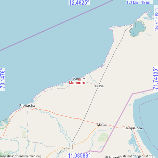
Manaure GPS coordinates[2]
11° 46' 30.18" North, 72° 26' 40.092" West
| Map corner | latitude | longitude |
|---|---|---|
| Upper-left | 12.4625°, | -73.1476° |
| Center: | 11.77505°, | -72.44447° |
| Lower-right: | 11.08588°, | -71.74135° |
| Map W x H: | 153.1×153.1 km | = 95.1×95.1mi |
| max Lat: | 13.38166° ⇑0.3% North |
| Manaure: | 11.77505° |
| min Lat: | ⇓99.7% South -4.21528° |
| min Long | Manaure | max Long |
| -81.70636° | -72.44447° | -67.06996° |
| W 96.6%⇐ | ⇒3.4% E |
Elevation
Elevation of Manaure is 3 m = 10 ft, and this is 1146.3 m = 3761 ft below average elevation for this country.
| Max E: |
3342 m = 10965 ft | 99.4% |
| Avg. | 1149.3 m = 3771 ft | |
| Manaure | 3 m = 10 ft | |
Min E: |
1 m = 3 ft | 0.6% |
See also: Colombia elevation on elevation.city.
Geographical zone
Manaure is located in North Torrid zone (between Equator and Tropic of Cancer). Distance of this Northern Tropic circle is 1296.7 km =805.7 mi to North.| Distance of | km | miles | from Manaure |
|---|---|---|---|
| North Pole | 8697.8 | 5404.6 | to North |
| Arctic Circle | 6091.9 | 3785.3 | to North |
| Tropic Cancer | 1296.7 | 805.7 | to North |
| Equator | 1309.3 | 813.6 | to South |


Nearby cities:
15 places around Manaure: (largest is in red/bold)
• Albania
70.2 km =43.6 mi,  193°
193°
• Barrancas
98.7 km =61.3 mi,  202°
202°
• Dibulla
109.5 km =68 mi,  239°
239°
• Distracción
108.8 km =67.6 mi,  206°
206°
• El Molino
135.3 km =84.1 mi, 202°
• Fonseca
108.2 km =67.2 mi, 204°
• La Jagua del Pilar
156.4 km =97.2 mi, 205°
• Maicao
49.4 km =30.7 mi,  153°
153°
• Manaure Balcón del Cesar
166.5 km =103.5 mi, 202°
• Riohacha
56.5 km =35.1 mi, 243°
• San Juan del Cesar
127.2 km =79 mi, 208°
• Uribia
20.6 km =12.8 mi,  108°
108°
• Urumita
148.7 km =92.4 mi, 204°
• Valledupar
170.5 km =105.9 mi, 211°
• Villanueva
142.3 km =88.4 mi, 204°
Sources, notices
• [Note1] Compared only with cities in Colombia existing in our database
• [Src1] Map data: © OpenStreetMap contributors (CC-BY-SA)
• [Src2] Other city data from geonames.org with taken over terms of usage.
• [Src3] Geographical zone / Annual Mean Temperature by Robert A. Rohde @ Wikipedia
