San Miguel de Sema geodata
San Miguel de Sema (Boyacá) is a seat of a second-order administrative division; located in Colombia in America/Bogota (GMT-5) time zone. With population of 647 people, there are 1009 cities with bigger population in this country. Compared to other cities in Colombia, 50.2% of cities are located further ↑North; 71.2% of cities are located further ←West and 93.2% of cities have lower elevation than San Miguel de Sema. Note1


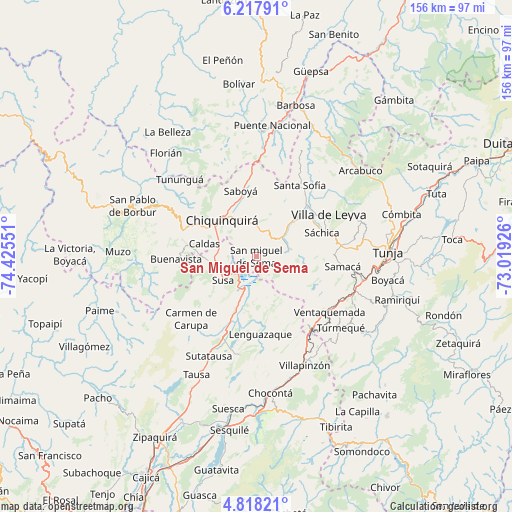
San Miguel de Sema GPS coordinates[2]
5° 31' 6.492" North, 73° 43' 20.568" West
| Map corner | latitude | longitude |
|---|---|---|
| Upper-left | 6.21791°, | -74.42551° |
| Center: | 5.51847°, | -73.72238° |
| Lower-right: | 4.81821°, | -73.01926° |
| Map W x H: | 155.6×155.6 km | = 96.7×96.7mi |
| max Lat: | 13.38166° ⇑50.2% North |
| San Miguel de Sema: | 5.51847° |
| min Lat: | ⇓49.8% South -4.21528° |
| min Long | San Miguel de S | max Long |
| -81.70636° | -73.72238° | -67.06996° |
| W 71.2%⇐ | ⇒28.8% E |
Elevation
Elevation of San Miguel de Sema is 2605 m = 8547 ft, and this is 1455.7 m = 4776 ft above average elevation for this country.
| Max E: |
3342 m = 10965 ft | 6.8% |
| San Miguel de Sema | 2605 m 8547 ft | |
| Avg. | 1149.3 m = 3771 ft | |
Min E: |
1 m = 3 ft | 93.2% |
See also: Colombia elevation on elevation.city.
Geographical zone
San Miguel de Sema is located in North Torrid zone (between Equator and Tropic of Cancer). Distance of Equator is 613.6 km =381.3 mi to South.| Distance of | km | miles | from San Miguel de Sema |
|---|---|---|---|
| North Pole | 9393.5 | 5836.8 | to North |
| Arctic Circle | 6787.6 | 4217.6 | to North |
| Tropic Cancer | 1992.3 | 1238 | to North |
| Equator | 613.6 | 381.3 | to South |


Nearby cities:
15 places around San Miguel de Sema: (largest is in red/bold)
• Buenavista
25.1 km =15.6 mi,  268°
268°
• Caldas
16.4 km =10.2 mi,  284°
284°
• Chiquinquirá
15.1 km =9.4 mi,  315°
315°
• Fúquene
15.1 km =9.4 mi,  212°
212°
• Guachetá
15.5 km =9.6 mi,  164°
164°
• Lenguazaque
23.5 km =14.6 mi,  177°
177°
• Ráquira
10.2 km =6.3 mi,  77°
77°
• Saboyá
20.5 km =12.7 mi,  345°
345°
• Santa Sofía
24.9 km =15.5 mi,  31°
31°
• Simijaca
14.5 km =9 mi,  263°
263°
• Susa
12.6 km =7.8 mi,  233°
233°
• Sutamarchán
15.9 km =9.9 mi,  47°
47°
• Sáchica
21.3 km =13.2 mi,  69°
69°
• Tinjacá
10.9 km =6.8 mi, 51°
• Villa de Leyva
25.4 km =15.8 mi,  59°
59°
Sources, notices
• [Note1] Compared only with cities in Colombia existing in our database
• [Src1] Map data: © OpenStreetMap contributors (CC-BY-SA)
• [Src2] Other city data from geonames.org with taken over terms of usage.
• [Src3] Geographical zone / Annual Mean Temperature by Robert A. Rohde @ Wikipedia
