El Carmen geodata
El Carmen (Norte de Santander) is a seat of a second-order administrative division; located in Colombia in America/Bogota (GMT-5) time zone. With population of 5,286 people, there are 490 cities with bigger population in this country. Compared to other cities in Colombia, 83.8% of cities are located further ↓South; 76.9% of cities are located further ←West and 60.3% of cities have higher elevation than El Carmen. Note1


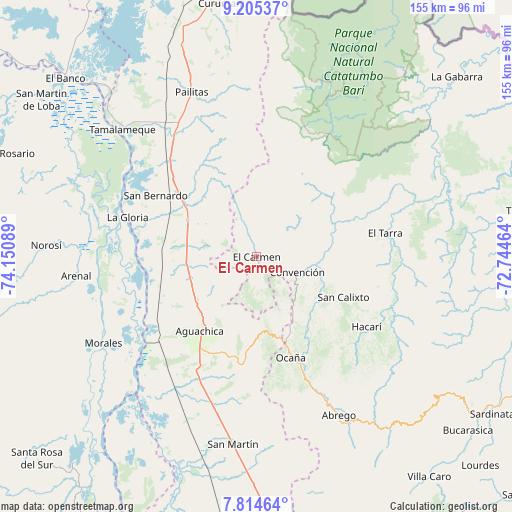
El Carmen GPS coordinates[2]
8° 30' 38.304" North, 73° 26' 51.936" West
| Map corner | latitude | longitude |
|---|---|---|
| Upper-left | 9.20537°, | -74.15089° |
| Center: | 8.51064°, | -73.44776° |
| Lower-right: | 7.81464°, | -72.74464° |
| Map W x H: | 154.6×154.6 km | = 96.1×96.1mi |
| max Lat: | 13.38166° ⇑16.2% North |
| El Carmen: | 8.51064° |
| min Lat: | ⇓83.8% South -4.21528° |
| min Long | El Carmen | max Long |
| -81.70636° | -73.44776° | -67.06996° |
| W 76.9%⇐ | ⇒23.1% E |
Elevation
Elevation of El Carmen is 712 m = 2336 ft, and this is 437.3 m = 1435 ft below average elevation for this country.
| Max E: |
3342 m = 10965 ft | 60.3% |
| Avg. | 1149.3 m = 3771 ft | |
| El Carmen | 712 m = 2336 ft | |
Min E: |
1 m = 3 ft | 39.7% |
See also: Colombia elevation on elevation.city.
Geographical zone
El Carmen is located in North Torrid zone (between Equator and Tropic of Cancer). Distance of Equator is 946.3 km =588 mi to South.| Distance of | km | miles | from El Carmen |
|---|---|---|---|
| North Pole | 9060.8 | 5630.1 | to North |
| Arctic Circle | 6454.9 | 4010.9 | to North |
| Tropic Cancer | 1659.6 | 1031.2 | to North |
| Equator | 946.3 | 588 | to South |


Nearby cities:
15 places around El Carmen: (largest is in red/bold)
• Aguachica
29.2 km =18.1 mi,  219°
219°
• Convención
13 km =8.1 mi,  110°
110°
• El Tarra
39.5 km =24.5 mi,  79°
79°
• Gamarra
38.6 km =24 mi,  237°
237°
• González
15.4 km =9.6 mi,  151°
151°
• Hacarí
38.9 km =24.2 mi,  122°
122°
• La Gloria
40.8 km =25.4 mi,  287°
287°
• La Playa
40.3 km =25 mi, 145°
• Ocaña
32 km =19.9 mi,  161°
161°
• Pelaya
30.9 km =19.2 mi,  309°
309°
• Regidor
44.6 km =27.7 mi, 292°
• Río Viejo
43.9 km =27.3 mi,  281°
281°
• Río de Oro
25.3 km =15.7 mi, 164°
• San Calixto
29.1 km =18.1 mi, 114°
• Teorama
19.2 km =11.9 mi, 115°
Sources, notices
• [Note1] Compared only with cities in Colombia existing in our database
• [Src1] Map data: © OpenStreetMap contributors (CC-BY-SA)
• [Src2] Other city data from geonames.org with taken over terms of usage.
• [Src3] Geographical zone / Annual Mean Temperature by Robert A. Rohde @ Wikipedia
