La Jagua de Ibirico geodata
La Jagua de Ibirico (Cesar) is a seat of a second-order administrative division; located in Colombia in America/Bogota (GMT-5) time zone. With population of 18,555 people, there are 194 cities with bigger population in this country. Compared to other cities in Colombia, 91.4% of cities are located further ↓South; 79.6% of cities are located further ←West and 78.1% of cities have higher elevation than La Jagua de Ibirico. Note1


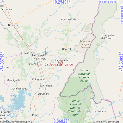
La Jagua de Ibirico GPS coordinates[2]
9° 33' 44.208" North, 73° 20' 2.58" West
| Map corner | latitude | longitude |
|---|---|---|
| Upper-left | 10.25491°, | -74.03718° |
| Center: | 9.56228°, | -73.33405° |
| Lower-right: | 8.86823°, | -72.63093° |
| Map W x H: | 154.2×154.2 km | = 95.8×95.8mi |
| max Lat: | 13.38166° ⇑8.6% North |
| La Jagua de Ibirico: | 9.56228° |
| min Lat: | ⇓91.4% South -4.21528° |
| min Long | La Jagua de Ibi | max Long |
| -81.70636° | -73.33405° | -67.06996° |
| W 79.6%⇐ | ⇒20.4% E |
Elevation
Elevation of La Jagua de Ibirico is 140 m = 459 ft, and this is 1009.3 m = 3311 ft below average elevation for this country.
| Max E: |
3342 m = 10965 ft | 78.1% |
| Avg. | 1149.3 m = 3771 ft | |
| La Jagua de Ibirico | 140 m = 459 ft | |
Min E: |
1 m = 3 ft | 21.9% |
See also: Colombia elevation on elevation.city.
Geographical zone
La Jagua de Ibirico is located in North Torrid zone (between Equator and Tropic of Cancer). Distance of Equator is 1063.2 km =660.6 mi to South.| Distance of | km | miles | from La Jagua de Ibirico |
|---|---|---|---|
| North Pole | 8943.8 | 5557.4 | to North |
| Arctic Circle | 6337.9 | 3938.2 | to North |
| Tropic Cancer | 1542.7 | 958.6 | to North |
| Equator | 1063.2 | 660.6 | to South |


Nearby cities:
15 places around La Jagua de Ibirico: (largest is in red/bold)
• Agustín Codazzi
53.8 km =33.4 mi,  11°
11°
• Astrea
70.7 km =43.9 mi,  264°
264°
• Becerril
16.9 km =10.5 mi,  20°
20°
• Bosconia
75.8 km =47.1 mi,  306°
306°
• Chimichagua
62.4 km =38.8 mi,  237°
237°
• Chiriguaná
36.9 km =22.9 mi,  233°
233°
• Curumaní
46.3 km =28.8 mi,  209°
209°
• El Banco
94.1 km =58.5 mi, 228°
• El Copey
94.9 km =59 mi, 313°
• El Paso
46.5 km =28.9 mi,  283°
283°
• El Peñón
92.8 km =57.7 mi, 226°
• La Paz
93.1 km =57.8 mi, 10°
• Pailitas
74.6 km =46.4 mi, 205°
• San Diego
87.7 km =54.5 mi, 10°
• Tamalameque
94.8 km =58.9 mi, 213°
Sources, notices
• [Note1] Compared only with cities in Colombia existing in our database
• [Src1] Map data: © OpenStreetMap contributors (CC-BY-SA)
• [Src2] Other city data from geonames.org with taken over terms of usage.
• [Src3] Geographical zone / Annual Mean Temperature by Robert A. Rohde @ Wikipedia
