Chíquiza geodata
Chíquiza (Boyacá) is a seat of a second-order administrative division; located in Colombia in America/Bogota (GMT-5) time zone. With population of 730 people, there are 996 cities with bigger population in this country. Compared to other cities in Colombia, 52% of cities are located further ↓South; 76% of cities are located further ←West and 93.3% of cities have lower elevation than Chíquiza. Note1


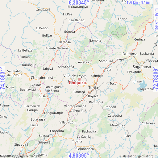
Chíquiza GPS coordinates[2]
5° 36' 14.832" North, 73° 29' 6.648" West
| Map corner | latitude | longitude |
|---|---|---|
| Upper-left | 6.30345°, | -74.18831° |
| Center: | 5.60412°, | -73.48518° |
| Lower-right: | 4.90395°, | -72.78206° |
| Map W x H: | 155.6×155.6 km | = 96.7×96.7mi |
| max Lat: | 13.38166° ⇑48% North |
| Chíquiza: | 5.60412° |
| min Lat: | ⇓52% South -4.21528° |
| min Long | Chíquiza | max Long |
| -81.70636° | -73.48518° | -67.06996° |
| W 76%⇐ | ⇒24% E |
Elevation
Elevation of Chíquiza is 2606 m = 8550 ft, and this is 1456.7 m = 4779 ft above average elevation for this country.
| Max E: |
3342 m = 10965 ft | 6.7% |
| Chíquiza | 2606 m 8550 ft | |
| Avg. | 1149.3 m = 3771 ft | |
Min E: |
1 m = 3 ft | 93.3% |
See also: Colombia elevation on elevation.city.
Geographical zone
Chíquiza is located in North Torrid zone (between Equator and Tropic of Cancer). Distance of Equator is 623.1 km =387.2 mi to South.| Distance of | km | miles | from Chíquiza |
|---|---|---|---|
| North Pole | 9383.9 | 5830.9 | to North |
| Arctic Circle | 6778.1 | 4211.7 | to North |
| Tropic Cancer | 1982.8 | 1232.1 | to North |
| Equator | 623.1 | 387.2 | to South |


Nearby cities:
15 places around Chíquiza: (largest is in red/bold)
• Arcabuco
17.6 km =10.9 mi,  17°
17°
• Cucaita
7.5 km =4.7 mi,  153°
153°
• Cómbita
18.1 km =11.2 mi,  79°
79°
• Gachantivá
18 km =11.2 mi,  340°
340°
• La Capilla
11.3 km =7 mi,  5°
5°
• Motavita
13.4 km =8.3 mi,  103°
103°
• Ráquira
17.8 km =11.1 mi,  245°
245°
• Samacá
12.4 km =7.7 mi,  180°
180°
• Santa Sofía
17.6 km =10.9 mi,  311°
311°
• Sora
5.8 km =3.6 mi,  138°
138°
• Sutamarchán
14.6 km =9.1 mi,  274°
274°
• Sáchica
6.6 km =4.1 mi, 250°
• Tinjacá
17.9 km =11.1 mi,  261°
261°
• Tunja
15.1 km =9.4 mi,  120°
120°
• Villa de Leyva
5.5 km =3.4 mi, 307°
Sources, notices
• [Note1] Compared only with cities in Colombia existing in our database
• [Src1] Map data: © OpenStreetMap contributors (CC-BY-SA)
• [Src2] Other city data from geonames.org with taken over terms of usage.
• [Src3] Geographical zone / Annual Mean Temperature by Robert A. Rohde @ Wikipedia
