Ráquira geodata
Ráquira (Boyacá) is a seat of a second-order administrative division; located in Colombia in America/Bogota (GMT-5) time zone. With population of 2,120 people, there are 783 cities with bigger population in this country. Compared to other cities in Colombia, 50.5% of cities are located further ↓South; 72.6% of cities are located further ←West and 83.2% of cities have lower elevation than Ráquira. Note1


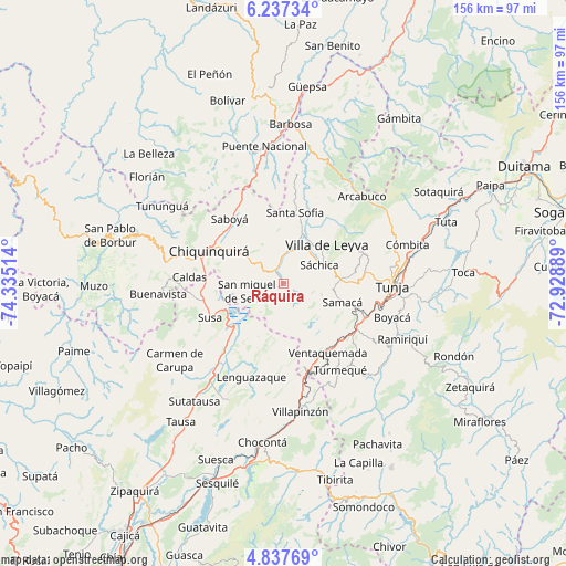
Ráquira GPS coordinates[2]
5° 32' 16.548" North, 73° 37' 55.236" West
| Map corner | latitude | longitude |
|---|---|---|
| Upper-left | 6.23734°, | -74.33514° |
| Center: | 5.53793°, | -73.63201° |
| Lower-right: | 4.83769°, | -72.92889° |
| Map W x H: | 155.6×155.6 km | = 96.7×96.7mi |
| max Lat: | 13.38166° ⇑49.5% North |
| Ráquira: | 5.53793° |
| min Lat: | ⇓50.5% South -4.21528° |
| min Long | Ráquira | max Long |
| -81.70636° | -73.63201° | -67.06996° |
| W 72.6%⇐ | ⇒27.4% E |
Elevation
Elevation of Ráquira is 2165 m = 7103 ft, and this is 1015.7 m = 3332 ft above average elevation for this country.
| Max E: |
3342 m = 10965 ft | 16.8% |
| Ráquira | 2165 m 7103 ft | |
| Avg. | 1149.3 m = 3771 ft | |
Min E: |
1 m = 3 ft | 83.2% |
See also: Colombia elevation on elevation.city.
Geographical zone
Ráquira is located in North Torrid zone (between Equator and Tropic of Cancer). Distance of Equator is 615.8 km =382.6 mi to South.| Distance of | km | miles | from Ráquira |
|---|---|---|---|
| North Pole | 9391.3 | 5835.5 | to North |
| Arctic Circle | 6785.4 | 4216.3 | to North |
| Tropic Cancer | 1990.2 | 1236.7 | to North |
| Equator | 615.8 | 382.6 | to South |


Nearby cities:
15 places around Ráquira: (largest is in red/bold)
• Chiquinquirá
22.3 km =13.9 mi,  293°
293°
• Chíquiza
17.8 km =11.1 mi,  65°
65°
• Cucaita
19.7 km =12.2 mi,  88°
88°
• Guachetá
18.1 km =11.2 mi,  199°
199°
• Saboyá
23.3 km =14.5 mi,  319°
319°
• Samacá
17 km =10.6 mi,  107°
107°
• San Miguel de Sema
10.2 km =6.3 mi,  257°
257°
• Santa Sofía
19.3 km =12 mi,  9°
9°
• Sora
20.4 km =12.7 mi,  81°
81°
• Susa
22.3 km =13.9 mi,  244°
244°
• Sutamarchán
8.8 km =5.5 mi, 10°
• Sáchica
11.2 km =7 mi,  62°
62°
• Tinjacá
4.8 km =3 mi,  342°
342°
• Ventaquemada
22.6 km =14 mi,  146°
146°
• Villa de Leyva
16 km =9.9 mi,  48°
48°
Sources, notices
• [Note1] Compared only with cities in Colombia existing in our database
• [Src1] Map data: © OpenStreetMap contributors (CC-BY-SA)
• [Src2] Other city data from geonames.org with taken over terms of usage.
• [Src3] Geographical zone / Annual Mean Temperature by Robert A. Rohde @ Wikipedia
