Cajamarca geodata
Cajamarca (Tolima) is a populated place; located in Colombia in America/Bogota (GMT-5) time zone. With population of 9,309 people, there are 328 cities with bigger population in this country. Compared to other cities in Colombia, 72.2% of cities are located further ↑North; 64.5% of cities are located further →East and 74.4% of cities have lower elevation than Cajamarca. Note1


Cajamarca GPS coordinates[2]
4° 26' 32.424" North, 75° 25' 43.464" West
| Map corner | latitude | longitude |
|---|---|---|
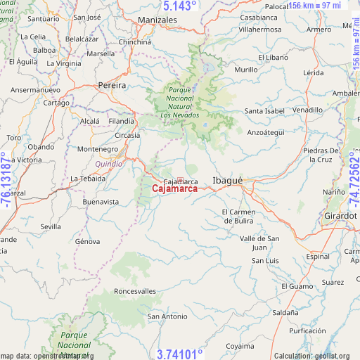
| Upper-left | 5.143°, | -76.13187° |
| Center: | 4.44234°, | -75.42874° |
| Lower-right: | 3.74101°, | -74.72562° |
| Map W x H: | 155.9×155.9 km | = 96.9×96.9mi |
| max Lat: | 13.38166° ⇑72.2% North |
| Cajamarca: | 4.44234° |
| min Lat: | ⇓27.8% South -4.21528° |
| min Long | Cajamarca | max Long |
| -81.70636° | -75.42874° | -67.06996° |
| W 35.5%⇐ | ⇒64.5% E |
Elevation
Elevation of Cajamarca is 1818 m = 5965 ft, and this is 668.7 m = 2194 ft above average elevation for this country.
| Max E: |
3342 m = 10965 ft | 25.6% |
| Cajamarca | 1818 m 5965 ft | |
| Avg. | 1149.3 m = 3771 ft | |
Min E: |
1 m = 3 ft | 74.4% |
See also: Colombia elevation on elevation.city.
Geographical zone
Cajamarca is located in North Torrid zone (between Equator and Tropic of Cancer). Distance of Equator is 493.9 km =306.9 mi to South.| Distance of | km | miles | from Cajamarca |
|---|---|---|---|
| North Pole | 9513.1 | 5911.2 | to North |
| Arctic Circle | 6907.2 | 4291.9 | to North |
| Tropic Cancer | 2112 | 1312.3 | to North |
| Equator | 493.9 | 306.9 | to South |


Nearby cities:
15 places around Cajamarca: (largest is in red/bold)
• Anaime
5.4 km =3.4 mi,  199°
199°
• Armenia
29.8 km =18.5 mi,  289°
289°
• Buenavista
35.6 km =22.1 mi,  255°
255°
• Calarcá
25.4 km =15.8 mi, 292°
• Circasia
30.2 km =18.8 mi,  310°
310°
• Coello
15.5 km =9.6 mi,  106°
106°
• Córdoba
29.2 km =18.1 mi, 258°
• Filandia
36.3 km =22.6 mi,  315°
315°
• Ibagué
21.8 km =13.5 mi,  91°
91°
• La Tebaida
39.8 km =24.7 mi,  271°
271°
• Laureles
23.5 km =14.6 mi,  149°
149°
• Montenegro
38.3 km =23.8 mi, 291°
• Pijao
32.9 km =20.4 mi,  248°
248°
• Rovira
30.8 km =19.1 mi,  137°
137°
• Salento
26.8 km =16.7 mi, 324°
Sources, notices
• [Note1] Compared only with cities in Colombia existing in our database
• [Src1] Map data: © OpenStreetMap contributors (CC-BY-SA)
• [Src2] Other city data from geonames.org with taken over terms of usage.
• [Src3] Geographical zone / Annual Mean Temperature by Robert A. Rohde @ Wikipedia
